India occupies a central position in South Asia. The country is located throughout the Hindustan peninsula up to the Himalayan range, thus becoming not only the largest in the region, but also the seventh largest in the world.
From the south, southeast and southwest it is washed by waters indian ocean. A detailed map of India shows that, despite the abundance of coastal zones, the country does not have large island territories, except for the Andaman and Nicobar archipelagos.
India currently ranks second in terms of population in the world. This figure has already exceeded 1340000000 people. The leader of the list, China, is only 50 million ahead of India, but with every year this gap is shrinking. And the population density of 360 people per km² makes the country one of the most densely populated regions in the world.
India on the world map: geography, nature and climate

With a territory of 3,287,263 km², finding India on the world map is not difficult. From the northwest, it borders on Pakistan, in the northeast, along a natural mountainous border, it has three more neighbors - China, Bhutan and Nepal, and in the east it touches Myanmar. Also in the eastern part of the coastal enclave in the interior of the country is Bangladesh, and in the northernmost provinces, India disputes border areas with Afghanistan with its closest neighbors.
The coastline of the country stretches for more than 7000 km. Therefore, India also borders other states by sea: with Sri Lanka in the south, the Maldives in the southwest and Indonesia in the southeast.
Geographical position
India, like any large country, is characterized by a significant variety of relief. The northeastern regions are located at the foot of the Himalayan mountains. The highest point in the country Mount Kanchenjunga. This is the third highest peak in the world - 8586 meters above sea level.
The central part of India is occupied by the Deccan Plateau, dotted with fertile river valleys. On the northwestern border is the Thar Desert, which occupies the historical territory of Rajasthan.
India is distinguished by an abundant water basin. Despite the absence of large lakes, the region abounds with full-flowing rivers. The largest ones such as Ganges and Brahmaputra originate in the Himalayas and flow into the Bay of Bengal. River indus, which gave the country its name, today mainly flows through the territory of Pakistan.
The coast of India has almost no relief and is represented by long beach lines in the west and marshy watts in the east.
Animal and plant world
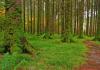
Indian river valleys have the most biodiversity on Earth. India is home to 6% of the flowering plants and 8.5% of the planet's animal species. The unique conditions of a number of Indian regions create the basis for a high endemicity of plant species. About a third of all plants in India do not grow anywhere else. In the northern and eastern mountainous regions, extensive coniferous and monsoon teak, sandalwood and bamboo forests changing to the south savannas and mixed evergreens forests. Trees such as sal and neem are common in the tropical plains. The sharp increase and increase in population density has threatened the extinction of thousands of rare species. In terms of the number of endangered animals and plants, India is among the leaders.
Climate
Due to the fact that the northern borders of the region are reliably covered by mountains from the cold Central Asian winds, the climatic conditions of the main part of India are relatively comfortable. The average winter temperature rises from north to south from 16 to 28°C. In summer it levels off, reaching 30-32°C everywhere, but severe droughts up to 45°C are not rare. Precipitation varies stylishly across the country.
In the central regions, it is 300-500 mm, most of which falls during the short rainy season. In the western desert regions, this figure barely reaches 100 mm.
Precipitation levels are much higher in the high mountain regions. So, the Shillong Plateau, located on the map of India in Russian in the north-eastern part of the country, is recognized as the rainiest place on Earth - more than 12,000 mm of precipitation per year.
Map of India with cities. Administrative division of the country

Due to its federal structure, India is divided into 29 states and 7 territories. The most dense (about 1000 people per km 2) population lives in the Ganges River valley and in a number of agglomerations of the western coast. A map of India with cities in Russian shows that in the central and southern regions the population density is quite uniform and fluctuates within the average for the country.
New Delhi
New Delhi is the official capital of India. In fact, this is a district of the city of Delhi, located in the northern part of India. Although the population of New Delhi does not exceed 300,000 people, it is here that all the highest government bodies of the country are concentrated.
Mumbai
Mumbai, known as Bombay until 1995, is the largest city in India. Located on the coast of the Arabian Sea, the city is the commercial, industrial and technological capital of the country. The standard of living of the population here is higher than in other regions of India.
Kolkata
Kolkata (until 2001 - Calcutta) is the fourth most populous city in the country, located in the Ganges Delta. Historically the capital of British India, Calcutta remains the center of Indian culture and learning.
Where is India located on the world map? The Republic of India is a unique and interesting state in South Asia. The capital of the country is New Delhi. From the western part of the country borders with Pakistan, from the northeast with China, Bhutan and Nepal. On the east side with Bangladesh and Myanmar. India also has sea borders with the Maldives from the southwest, Sri Lanka from the south and Indonesia from the southeast.
Many are wondering if there are direct flights and how long will it take to fly to India? It turns out that a direct flight from Moscow to India is possible, but only during a certain period.
On the coastal map of India, you can see that the country is washed by the waters of the Indian Ocean, and the largest rivers flow through the territory, which originate in the Himalayas: the Ganges and the Brahmaputra. These two rivers flow into the Bay of Bengal.
Coastal map of India
On a detailed map with cities and states in Russian, we can see that India consists of 29 states and seven union territories. The most visited states among tourists are: Andhra Pradesh, where there are many different temples and very picturesque nature; Hyderabad is the country's most developed information technology center and is also known for its many historical and architectural attractions.
 Map with cities and states of India
Ancient India is one of the first world civilizations, whose history began with the emergence of the Indus Valley Civilization.
The Indian, or Harappan, civilization is one of the three most ancient civilizations of mankind, along with the ancient Egyptian and Sumerian.
In the 7th millennium BC, a manufacturing economy began to develop in the Indus Valley and Saraswati. At that time, the Mergar culture was known. People found an effective way to get food, began to engage in agriculture, hunting and cattle breeding. Thanks to all this, a new cultural and historical complex was gradually formed.
The peoples who inhabited South India were called Dravidians.
They actively developed monumental construction, bronze metallurgy and small sculpture.
Interesting to know: in Mohenjo-Daro, archaeologists discovered almost the first public toilets, as well as the city sewerage system.
Since scientists still cannot decipher the writing of the Indus Valley, it is impossible to judge the political development of Harappa and Mohenjo-Daro, and the names of the rulers remain unknown.
It is known that foreign trade played an important role for the inhabitants of ancient India.
In the XVIII-XVII centuries BC, the Dravidian population began to move to the southeast, and lost its former level of development. Presumably, this was caused by the deterioration of natural conditions. The last blow to the Harappan civilization came from the Aryan invasion, which was described in the Rigveda ─ the most ancient source of texts. The H cemetery culture is one of the descendants of the Indus civilization.
The Vedic period followed the Indus civilization.
Most scientists believe that the Vedic civilization existed in the period of the II-I millennium BC, and Indian scientists believe that the Vedic civilization began its existence in the 7th millennium BC.
Wherever the ancestral home of the Indo-Europeans is located - in Asia or in Eastern Europe, it is assumed that the Indo-Iranians separated from them before all other individual peoples. After that, they obviously lived for a long time together with the ancient Iranians in Iran, where a common Indo-Iranian culture was developed.
This connection is evidenced not only by the similarity of the language, but also by the commonality of religious and cultural ideas.
It is impossible to say what made the Indo-Aryans separate from their relatives the Iranians and go to India.
It is also unknown when this happened. In any case, the Indo-Aryans left Iran before they created their oldest literary monument - the Rigveda. Usually its creation is attributed to 1500-2000 BC.
At that time, the Indo-Aryans lived in northwestern India and specifically in the Punjab, because in the Rigveda, in the main, only the names of the rivers of the Punjab are found. In this era, the Hindus called themselves "Aryans", which means "noble". The history of India, almost to the era of Buddhism, is the history of the gradual conquest of the Hindustan peninsula by Aryan aliens and the displacement of non-Aryan natives.
Even then, the Hindus were an agricultural people, they cultivated the land with a plow, which was harnessed by oxen.
An important role was played by cattle breeding, cows, sheep, goats, horses, donkeys, and dogs were bred.
Interesting to know: among the Hindus, the cow was an object of worship; prayers for the gift of cow herds were constantly heard in the hymns.
Gods and heroes were compared to bulls, dawn and rain clouds were compared to cows.
Of the crafts, carpentry, cartwork, blacksmithing, pottery, tanning, weaving, sewing, and knitting were known. There were no cities as such, they lived in villages, which were sometimes fortified. The whole people was divided into peoples, which were divided into tribes, and the latter - into villages or communities. At the head of the people was a king or leader, at the head of a tribe - a foreman, and at the head of a clan or community - an elder.
The Vedic Hindus were distinguished by their militancy, and they fought not only with enemies, but sometimes with each other.
The battle was on chariots, there were no riders. On the chariot were the fighter himself and his driver. Hand-to-hand combat was also used. The armament consisted of a shell that covered the shoulders and upper body, a helmet, a bow, and on the hand the arrows wore a special belt that protected them from being hit by a lowered bowstring. The arrowheads were poisoned.
Since there was no written language yet, the hymns were passed down orally from generation to generation.
Great love enjoyed the music, which was accompanied by prayers to the gods, the highest and purest of which is Varuna. He reigns over all life and light.
The rest of the gods are subordinate to Varuna, they can be divided into three groups: the gods of visible celestial light phenomena, the gods of air space, winds, etc., the gods residing on earth.
Around 1200 B.C., Hindus begin to migrate from the Punjab further east and occupy the upper reaches of the Ganges and Yamuna and the Saraswati and Drshadwati rivers.
Large cities and capitals of famous dynasties appear.
Castes arise, the importance and power of the priests increase. The doctrine of the transmigration of souls arises. In this era, India is already trading with other countries. Sacrifice becomes the center of all religious life.
Brahmins (priests) declare themselves gods, forming a special class of gods.
In the Yajurveda, the following estates are formed:
- brahmin priests;
- rajanya (royal) or kshatriya (dominant, noble);
- vaishya (peasants);
- Sudra (non-Aryan or mixed population).
Interesting to know: there are four stages of personal life - ashrams, of which a brahmin must go through all four, a kshatriya - three, a vaishya - two.
Every boy between the ages of 7 and 12 (Brahmin on the 8th-10th, Kshatriya on the 11th, Vaishya on the 12th) is given to a Brahmin teacher to learn the Vedas. This stage is called brahmachanin (student). The following: grhastha (household), in which a student of the Vedas can get married and get his own house; vanaprastha, when one who has raised his children goes into the forest and becomes a "forest hermit"; samnyasin - "renounced the world."
From the 5th century BC, the Buddhist period in the history of ancient India begins.
It was at this time that the Buddha lived - a being who achieved enlightenment. In cultural terms, at this time, the main event is the spread of iron tools. Trade and market relations are intensively developing.
Cities of many thousands are formed, royal power is strengthened, and the number of slave forces is increasing. Magadha becomes the strongest state in Northern India, and its capital Pataliputra becomes the largest and richest city. Magadha reached its special power in the 4th century BC, when the Nanda dynasty was in power. It was this dynasty that united the waters with its power over the entire Ganges basin.
Soon the Punjab and the Indus Valley united under the rule of Chandragupta of the Mauryan family.
At the end of the 4th century BC, he conquered Cambodia, Gandhara and adjacent regions of Eastern Iran. His successors were Bindurasa and Ashoka. In the entire history of ancient India, Ashoka was the most powerful ruler. He exterminated all his brothers and unleashed devastating wars in the south, annexing almost the entire Deccan. Later, however, Ashoka's tyranny was replaced by a policy of "spreading goodness" within the empire, where Buddhism played a major role.
By the end of the 3rd century BC, the Mauryan empire began to rapidly disintegrate. This dynasty was finally overthrown in Magadha in 180 BC.

ancient india

God of War Skanda

Sculpture of ancient India

Painting of ancient India
Where is India located?
India is located in Asia, in GMT+5:30 time zone (with current time of 06:37 PM, Wednesday).
Offset from its time zone: h. The country is located on an area of 3287590 km² with a population of about 1173.1 million people. Neighbor countries: China, Nepal, Myanmar, Bhutan, Pakistan, Bangladesh.
Capital of India?
The capital of India is New Delhi.
IND latitude and longitude
India on the world map

Largest cities in India
Mumbai
Delhi
Bangalore
Kolkata
chennai
Ahmedabad
Hyderabad
Pune
Surat
Kanpur
Jaipur
Map of India in Russian
Detailed map of India in Russian. Map of roads, cities and countries on the map of India.
Show on map India.
Where is India on the world map?
What types of names are not taken into account in this wonderful country: "continent of the state", "state of a thousand wonders", "land of contrasts",
However, none of them fully reflect the palette of emotions that a trip to India provides you with. The state is located in South Asia and is the largest in terms of territory and population in the region.
Interactive map of India with cities and countries
India combines picturesque old architecture (Khajuraho, Agra), a sacred river (Ganges), a beautiful beach (Goa) and a tour of the rest (Dudshagar Falls, Corbett National Park, the floating islands of Loktak Lake, Mumbai).
The extraordinary beauty of nature and the unique culture of this ancient country attracts and for a long time does not allow anyone who has ever managed to be here.
India countries on the map
On the state structure of the country, it is a federal republic of 29 countries, 6 trade union territories and the capital Delhi. The country includes the following states: Andhra Pradesh, Arunachal Pradesh, Assam, Bihar, Goa, Gujarat, Jharkhand, Jammu and Kashmir, West Bengal, Orissa, Karnataka, Kerala, Madhya Pradesh, Manipur, Maharashtra, Meghalaya, Mizoram, Nagaland , Punjab, Sikkim, Rajasthan, Tamil Nadu, Tripura, Telingana, Uttarakhand, Uttar Pradesh, Haryana, Himachal Pradesh and Chhattisgarh.
India also includes neighboring territories such as Lakshadweep or Andaman and Nicobar.
Geographic location of India
India is located south of the equator, and in most of the Precambrian Indian Plate, which form the Indian subcontinent and adjacent to the north of the Indo-Gangetic plains. India Geographic coordinates: 20 ° 00 "s.
sh. and 77 ° 00 ‘E. e.
Indian Territory
The country occupies an important territory: its area is 3,287,263 square kilometers. km, which is the seventh indicator in the world. From snowy peaks in the north to palm trees in the south, Indian countries reach 3214 kilometers. Between the east and west of the country is more than 2933 kilometers. The coast of the Indian Ocean state ocean water is the Bay of Bengal in the southeast and the Arabian Sea in the southwest.
borders of india
India borders Pakistan to the west, Bhutan and Nepal to the northeast, Myanmar and Bangladesh to the east.
Water borders separate the country from the Maldives in the southwest, Sri Lanka in the south, and Indonesia in the southeast. The disputed territory, which contains the state of Jammu and Kashmir, borders Afghanistan.
The total length of India's borders is 14,103 km.

India on the world map

Indian regions on the map
India is located in South Asia, on the Hindustan Peninsula. The total area of the country is 3.3 million square meters. km. On the map, India looks like an almost isosceles triangle. At its base are the Himalayan mountains.
The length of the territory from north to south is about 3200 km, from east to west - 3000 km.
The length of the land border of India is 15,200 km. The maritime border stretches for 6083 km.
In the north, the state borders on Afghanistan, Bhutan, China and Nepal. In the east, there are borders with Bangladesh and Myanmar (Burma), in the west, the country borders with Pakistan. In the east, India is washed by the waters of the Bay of Bengal, in the south - by the Strait of Polk and the Indian Ocean, in the west - by the Arabian Sea.
The state also includes the Andaman and Nicobar, Laccadive, Amindive Islands and Minicoy in the southeastern part of the Arabian Sea.
Most of the territory of the state is occupied by the Deccan highlands.
It is bounded on both sides by the Eastern and Western Ghats. In total, there are 7 mountain ranges in the country. The highest of them are the Himalayas.
Between the Deccan and the Himalayas is the vast Indo-Gangetic lowland (Djamno-Gangetic plain). Narrow plains also extend along the coasts.
India attracts travelers from all over the world. And there are good reasons for this. This country is full of not only a huge number of resorts with a high level of service, it is also full of ancient sights. Let's find out where India is located on the world map.
India on the world map in Russian - photo

The time has come to get to know the geographical position of India, and everyone will decide for himself how far this paradise is from us.
India is a country rich in culture and history, Buddhism was born here.
What continent and peninsula is the country on?
The country, resembling a diamond in shape, is located on the mainland of Eurasia, to be more precise - in South Asia. The peninsula on which India is located is called Hindustan. It is one of the most Earth.
Lies India entirely in southern hemisphere planets. If we consider the location of India relative to conditional lines, then the equator passes from below without touching the borders of the country. At the same time, the state is located east of the zero meridian, which also passes by the state.
Where are the borders?

In the southwest it borders with Pakistan and Afghanistan, in the southeast with Nepal and the state of Myanmar. Fully washed Indian Ocean, the shores overlook the Arabian Sea and the Bay of Bengal.
From north to south, the country stretches for 3200 km, from east to west - 2930 km. All square, including islands such as Andaman, Nicobar and Laccadive - 3,287,590 sq. km.
State structure
India is parliamentary republic, which is headed by the President, who serves for 5 years.
Administrative division
In 1947, the British colony was divided into India and Pakistan, it was then that the country became independent. According to the constitution, it was divided into 29 states, which in turn were divided into categories that were formed according to the forms of government: A, B, and C. But in 1956 there were changes in the structure of the country, the division of states into groups was eliminated, but their number has been preserved to this day.
As we now know, India is divided into 29 different states and 7 union territories, including the National Capital Territory of Delhi.

Each state has its own executive and legislative bodies, governs them governor. All governing bodies are elected for a term of 5 years. Each state also has its own parliament, which deals with matters relating only to life within the state. The problems of foreign policy, trade and defense of the country are dealt with by the central government.
The union territories do not have their own governing bodies, they are in the hands of the same central government of India.
Big cities

How to get there?
After all the interesting information above, few people have any doubts about traveling to India for a week or two.
Timezone
It's time to learn about the time zone in this country. Now we need to remember that we have freed ourselves from the transfer of time to winter and summer, but India is not, we need this take account of.
Read also about which airlines and how to fly to India.
Concerning time difference s , it is +1 hour 30 minutes. That is, when the clock struck 13:00 in the capital of Russia, it was already 14:30 in India.
When it is 14:30 in India, 14:00 in Chelyabinsk (-30 minutes difference), in Vladivostok it is 9:00 (-5 hours 30 minutes), and at 17:00 (+2 hours 30 minutes).
How long is the flight from Moscow?

And so you finally decided to go to India. How long is the flight from Moscow? The answer to the question depends on many factors: on the type of aircraft, wind speed and direction, and, since India is huge, which city you are heading to.
The shortest way from Moscow to Delhi, without transfers, it will take 6 hours 50 minutes.
Most long haul- in Dabolim, in, it will take from 10 to 20 hours, depending on the cities in which there will be a transfer.
Road from St. Petersburg
Residents are less fortunate. The fact is that direct flights does not exist, will have to do a transplant. Some people are so unlucky that the flight takes two days.
Airplane tickets can be purchased using this search form. Enter departure and arrival cities, departure date and number of passengers.
Despite some difficulties with the flight, it is still worth it to find yourself in such a wonderful country in order to enjoy the culture and history, bring home traditional souvenirs, as well as photographs from the most beautiful beaches.
See video about traveling through the cities of India:
Detailed map of India in Russian. Map of roads, cities and states on the map of India. Show India on the map.
Where is India located on the world map?
What names have not been invented for this amazing country: "the country of the continent", "the country of a thousand wonders", "the country of contrasts". But none of them will fully reflect the palette of emotions that a trip to India guarantees you. The state is located in South Asia and is the largest in terms of territory and population in this region.
Interactive map of India with cities and states
India combines picturesque ancient architecture (Khajuraho, Agra), sacred rivers (Ganges), magnificent beach (Goa) and sightseeing holidays (Dudhsagar Waterfall, Corbett National Park, floating islands of Loktak Lake, Mumbai). The extraordinary beauty of nature and the unique culture of this ancient state attracts and does not let go for a long time anyone who has ever been lucky enough to visit here.
States of India on the map
According to the state system, the country is a federal republic, consisting of 29 states, 6 union territories and the capital district of Delhi. The state includes the following states: Andhra Pradesh, Arunachal Pradesh, Assam, Bihar, Goa, Gujarat, Jharkhand, Jammu and Kashmir, West Bengal, Orissa, Karnataka, Kerala, Madhya Pradesh, Manipur, Maharashtra, Meghalaya, Mizoram, Nagaland, Punjab, Sikkim, Rajasthan, Tamil Nadu, Tripura, Telingana, Uttarakhand, Uttar Pradesh, Haryana, Himachal Pradesh and Chhattisgarh. India also includes union territories such as Lakshadweep or the Andaman and Nicobar Islands.

Geographic location of India
India is located south of the equator, and most of it is located on the Precambrian Hindustan Plate, which forms the Hindustan Peninsula and the Indo-Gangetic Plain adjacent to the north. Geographical coordinates of India: 20 ° 00 "N and 77 ° 00" E. d.
Territory of India
The country occupies a significant territory: its area is 3,287,263 square kilometers, which is the 7th indicator in the world. From snowy peaks in the north to swaying palm trees in the south, India's possessions stretch for 3,214 kilometers. There are more than 2933 kilometers between the east and west of the country. The shores of the state are washed by the waters of the Indian Ocean - the Bay of Bengal in the southeast and the Arabian Sea in the southwest.
(Republic of India)
General information
Geographical position. In the south, east and west, the country is washed by the Arabian, Laccadive and Bengal seas and the Bay of Bengal of the Indian Ocean. India borders Pakistan, in the north the Himalayas separate the country from China and Bhutan, Nepal in the northeast and Bangladesh in the east.
Geographical position. India is a state in southern Asia from the peaks of the Karakorum in the north to Cape Kumari in the south, from the deserts of Rajasthan in the west to Bengal in the east.
Square. The territory of India occupies 3,269,000 square meters. km.
Main cities, administrative divisions. The capital of India is Delhi. Largest cities: Bombay (13,000 thousand people), Kolkata (11,500 thousand people), Madras (6,000 thousand people), Hyderabad (5,000 thousand people), Bangalore (4,600 thousand people) .). India is a federal republic, consisting of 25 states and 7 union territories of central subordination.
Political system
Included in the Commonwealth. The head of state is the president.
The legislature is a bicameral parliament.
Relief. India is clearly divided into three natural regions: the Himalayas, the Indo-Gangetic lowland and the Deccan Plateau. The Himalayas are a three-tiered mountain range in the north of the country. Foothills - the lower step, from 900 to 1200 m high, are called the Sivalik mountains. Between the second stage - the Small Himalayas, a chain of ridges of 3000-4000 m with peaks above 6000 m, and the third stage - the Great (High) Himalayas with the Nanga Parbat massif (8126 m) - lies the Kashmir Valley with many beautiful lakes. The Himalayas, West Bengal and Bihar lie in a seismically active zone. The earthquakes of 1737, 1833 and 1934 were especially destructive. The crescent of the Indo-Gangetic plain stretches from the Bay of Bengal to the Arabian Sea. The oldest part of the country is the Indian subcontinent. To the south of the Godavari River lies the Deccan plateau, 300 to 900 m above sea level, which occupies almost the entire Hindustan peninsula.
Geological structure and minerals. The bowels of the country contain reserves of coal, iron ore, natural gas, oil, manganese, titanium ore, chromite, diamonds, mica, boscite, limestone.
Climate. The climate in India is subequatorial, monsoon, tropical in the south. During the wet summer monsoon, 70 to 90 percent of precipitation falls, winters are dry and cool, and from March to May there is dry hot weather. The wettest place on earth is the Shillong Plateau, with up to 12,000 mm of precipitation per year. The average January temperature is from +15°С in the north to +27°С in the south. The hottest month is May. Average May temperatures: +28°С in the north, +35°С in the south. Usually there are three seasons in a year: hot, humid and cool.
Inland waters. The main rivers - the Ganges, the sacred river, with a tributary of the Jamna, the upper reaches of the Indus, the lower reaches of the Brahmaputra - are full-flowing and are used for irrigation.
Soils and vegetation. There are 21,000 plant species in India. A quarter of the country's territory is occupied by forests, among them the Kaziranga National Park and the Gir Forest Reserve. At the foot of the Himalayas there are swampy jungles, above - monsoon forests (teak, sandalwood), mountain mixed and coniferous (Himalayan cedar, spruce, pine, fir), even higher mountain meadows and steppes. In the foothills of the Eastern Himalayas, in the delta of the Ganges and the Brahmaputra, on the slopes of the Western Ghats, evergreen tropical forests grow. Mangrove forests grow on the coastal lowlands: sundri and dhani palm. Palm trees (coconut, date, toddy palm) and bamboo are common everywhere.
Animal world. The animal world is represented by 500 species of mammals, 350 species of reptiles, 3,000 species of birds, but some animals are preserved only in reserves (Asian lion, Manipur broad-horned deer, Kashmir deer, Nilgir tur, kulan, rhinoceros). The number of wild buffalo and barasing deer has decreased, snow leopard, clouded leopard, pygmy boar, and cheetah are rare. Many monkeys, not afraid of humans, mainly rhesus monkeys and langurs, sit along the roads. Palm squirrels and flying foxes (bats) are also not afraid of people and settle next to them, eating coconuts, bananas, mangoes and grapes. Of over 200 species of snakes, 52 are venomous. The rivers and coastal waters of the Indian Ocean are rich in fish. Sacred crocodiles live in the Ganges - gharials 6-7 m long. Indian dugong - a resident of the seas - the rarest animal in the world, belongs to the order of sea (siren) cows, the only herbivorous marine mammal. In India, there are a lot of insects, including malarial mosquitoes.
Population and language
Almost a billion people live in India. India is a multinational country: Hindustanis, Biharis (in the north and in the center of the country); Punjabis, Rajasthani, Marathas, Gujaratis (in the west); Bengalis, Assamese, Oriya (in the east); Dravidians - Telugu, Tamils, Kannarians, Malayalis (in the south) and others. The official languages are Hindi and English. Individual states have official indigenous languages.
Religion
85% of the country's inhabitants profess Hinduism, over 10% are Muslims, the remaining 5% are Christians, Buddhists, Sikhs, Jains, etc.
Brief historical outline
People engaged in fishing and hunting lived in India in the 4th millennium BC. e. The first civilization (Indian, also called proto-Indian or Harappan) developed in the Indus Valley in the middle of the 3rd millennium BC. e. and lasted for about a thousand years. Traces of this Dravidian civilization have been found on the Kathiyawar Peninsula in Gujarat, and in 1922 archaeologists discovered the remains of Bronze Age settlements: Harappa (in Punjab) and Mohenjo-Daro (in Sindh).
In the middle of the II millennium BC. e. The Aryans came to Northern India from Central Asia through the Indus basin and founded their states in the Ganges valley by the 7th-6th centuries. BC e. In the 5th century BC e. in the Ganges valley there were several small states that were at war with each other. IV century. BC e. The troops of Alexander the Great came to the north-west of India, successfully overcoming the resistance of the tribes living in the Indus Valley. However, in the Ganges valley the situation had changed by this time. The kings of the state of Magadha united the small states into one strong one and repelled the Greek-Macedonian attack. Soon, Chandragupta from the Maurya clan seized power in Magadha, and under his grandson Ashok (III century BC), the kings of Magadan ruled almost all of India (except for the very south of Hindustan), and their state is usually called the Mauryan Empire. The powerful Mauryan state collapsed at the beginning of the 2nd century. BC e. and began to be attacked by the Scythians, Greeks, etc.
VI century. n. e. in North-Western India, a huge Kushan empire was created, which reached its greatest power in the 2nd-3rd centuries. n. e., when it included Afghanistan, Central Asia and Indian territories up to the Narbad River. IV century. n. e. the state of Magadha reunited North India, and by the name of the ruling dynasty it is called the Gupta Empire. During this period, the architectural treatise "Manasar" was completed. Caste division is clearly reflected in the planning of cities. In the 5th century n. e. science was highly developed in India. The numbers (and the positional system of using them) that we use and call Arabic are borrowed from the Arabs, but the Arabs themselves adopted them from the Indians. The main invention of ancient Indian mathematicians is the introduction of zero into the digital system.
The ancient Indian tribes spoke different languages, but all educated people knew a single literary language - Sanskrit, which played the same unifying role in India as Latin did in medieval Europe. Artistic and religious works, laws and scientific works were written in Sanskrit. Sanskrit grammar compiled by an Indian scholar in the 5th century BC. e., the oldest grammar on earth. Poet and playwright n. e. Kalidasa played the same role in Indian literature as Shakespeare and Pushkin did in European literature. Invasion of the Hephthalite tribes from the northwest in the 5th c. n. e. led to the fall of the empire. On the territory of the Deccan Plateau, the kingdoms of the Satavahans, Vakatakas and Pallavas alternately arose and disintegrated; in the south, in the first centuries of our era, the state of Chera rose.
The period of the Indian Middle Ages lasts more than a thousand years (from the 7th to the 18th centuries) and is divided into two stages: the formation of small isolated feudal principalities and their disintegration; and then - the emergence of a centralized state - the Delhi Sultanate (XIII-XIV centuries). The second stage is completed by the Mughal Empire of the 16th-18th centuries. From the beginning of the XI century. India is being invaded by Muslims. The fragmented principalities could not offer serious resistance, and by the beginning of the 13th century. in Northern India, the Delhi Sultanate was formed with the supreme power of Muslim feudal lords, which expanded through the territories of Eastern and Southern India. By the end of the XIV century. Bengal and the principalities of the Deccan separated from the sultanate, and after the devastating invasion of Timur (Tamerlane), the sultanate disintegrated.
At the beginning of the XV century. in South India, the Vijayanagar empire was formed, which existed from 1336 to 1565. On the ruins of the Delhi Sultanate at the beginning of the 16th century. the power of the Great Moghuls appears, founded by Zahiruddin Muhammad Babur, and under his successors, especially under Akbar (1506-1605), it covered the entire Hindustan peninsula. The Mughal Empire was weakening, and in 1739 the ruler of Iran, Nadir Shah, occupied Delhi. The first Europeans - the Portuguese appeared off the coast of India in the XVI century. They captured Goa and other territories on the west coast. Then came the Dutch, French and British. Over the course of a century, East India companies arose in Western Europe in various countries, fighting for the colonization of India. By the 18th century The most powerful were the French East India Company, which arose in 1664, and the English East India Company, founded at the beginning of the 17th century. In 1757 the British captured Bengal. As a result of a clash of economic interests, the Anglo-French war broke out, ending in 1763 with the victory of England and the loss of almost all Indian possessions by France. The longest and most stubborn of the armed uprisings was the Great Popular Revolt of 1857, which the Indians themselves call the War of Independence. In 1858 the East India Company was abolished. Then the British authorities carried out administrative reforms, the supreme power was transferred to the British government.
The development of capitalism in the second half of the XIX century. led to the formation of the working class, and difficult working conditions led to strikes. By the end of the XIX century. Two directions were formed in the national movement: the bourgeois liberal, which did not call for the overthrow of the colonial regime, and the radical left, which demanded the elimination of feudal and colonial oppression. In 1885, an all-Indian party, the Indian National Congress, was created. At the beginning of the XX century. In India, a boycott of English goods, the swadeshi, began. A political strike was held in Bombay, workers' unions began to form, united in the All India Congress of Trade Unions. In the 1920s, the Satyagraha movement of civil disobedience began under the leadership of Gandhi. Lawyer Mohandas Gandhi returned to India from South Africa and devoted his life to combating discrimination against the indigenous population and for the independence of the country, especially after the shooting of unarmed demonstrators in Amritsar. The main merit of Gandhi is the involvement of peasants in the struggle for independence.
Under the pressure of the liberation movement, the British government issued in 1935 the Government of India Act, which provided for the creation of a legislative (in fact, an advisory) body and the granting of voting rights to the top of Indian society. This law only contributed to inciting ethnic and inter-caste hostility. During the Second World War and immediately after it, the liberation movement spread to the Indian army and navy, and England had to withdraw from India. On August 15, 1947, the creation of an independent Indian Union headed by Prime Minister Jawaharlal Nehru was announced, and the territories with a predominance of the Muslim population formed the Muslim state of Pakistan. The division was accompanied by inter-religious clashes and a mass exodus of Muslims from the territories remaining in India, and the problem of the border Kashmir still remains unresolved. On January 30, 1948, Gandhi was assassinated by a Hindu fanatic.
By 1956, as a result of the work of the government of Jawaharlal Nehru on the development of the economy and integration, more than 550 principalities had joined the Indian Union. January 26, 1950 India was proclaimed a republic and adopted a new constitution. The administrative reform of 1953 transformed the states according to the national language principle. The Nehru government began to pursue a policy of non-alignment. For almost twenty years, the industry and agriculture of the country has been steadily developing, but in the 70s, the economic situation of India worsened. The government of the National Congress that came to power in 1975, which dared to take emergency measures, did not improve the situation, as did the Janata (People's) party that won in 1977.
In 1980, the Indian National Congress party, led by Indira Gandhi, won a landslide victory in the elections. Over the next few years, the government of Indira Gandhi tried, albeit unsuccessfully, to fight unrest in various regions of the country, corruption, and caste division. In 1984, after the decision of Indira Gandhi to send Indian troops to suppress the Sikh radicals who occupied the Golden Temple in Amritsar, Indira Gandhi was killed by two of her Sikh bodyguards. The radicals demanded the separation of the Sikh state from India and the declaration of its independent state of Khalistan. After the assassination of Indira Gandhi, her youngest son Rajiv, a pilot of the Indian Airlines company, became involved in the political struggle, and after the death of his eldest son in a plane crash, he became the political heir to his mother. Rajiv Gandhi received great support.
Under Rajiv Gandhi, who pursued a new effective policy, foreign investments flowed into India, new technologies began to be used, and new industries were created. In the November 1989 elections, Rajiv Gandhi failed to form a one-party government of the National
congress. A coalition government of the National Front was formed, which included the fundamentalist Hindu Party, which did not last long, and a new election campaign began. During the campaign tour in Tamil Nadu, Rajiv Gandhi, many of his assistants and people who happened to be nearby died as a result of a bomb explosion. The Indian National Congress Party was led and led to victory in the elections by 70-year-old Narasimha Rao, who became prime minister.
Brief economic essay
India is an agro-industrial country. The economy is multifaceted. Agriculture is dominated by small and tiny farms. Main food crops: rice, wheat, millet, legumes, oilseeds. India occupies one of the first places in the world in the production of sugar cane, peanuts, tea, jute, castor beans, and cotton. They produce rubber, coffee, spices. Cattle, goats, sheep, as well as pigs, camels, poultry. Sericulture. Fishing. Extraction of manganese ore and mica (one of the first places in the world), iron ore, coal, bauxite, oil. Traditional industries: textile (mainly jute, cotton), food flavoring (sugar, tobacco), leather and footwear; there are oil refineries, cement, paper, glass enterprises. Ferrous and non-ferrous metallurgy and the chemical industry are developing. Exports: machinery and equipment, clothing, leather and leather products, chemical products, cotton fabrics, jute products, iron ore, tea, coffee, spices, cashew nuts, canned food, fish and seafood, diamonds.
The monetary unit is the Indian rupee.
A Brief Outline of Culture
Art and architecture. Delhi. Surrounded by fortified walls, the Old Town of the 17th century. Shahjahanabad. Here are the Red Fort, the Main Mosque (Jama Masjid); Divan-i-Kase (building of private audiences); royal baths (hammam); Pearl Mosque (1659); Kas Mahal (imperial palace); Colored Palace Rang Mahal; Archaeological Museum; Delhi Gate (1566); Jami-Masjid Mosque (1644-1658. The courtyard of the mosque can accommodate about 25 thousand people. The mosque rises above the city, as it stands on a square plinth 100 by 100 m, 10 m high and crowned with three huge white marble onion domes with black vertical intercepts). Calcutta. Victoria Memorial in Maidai Park; Ra-dyak-Bhavan (government house); cathedral of st. Paul; Botanical Garden. Agra. Mausoleum of the Taj Mahal; Pearl Mosque (XVII century); marble mausoleum of Jahangri Mahal. Bombay. Kanheri caves with rock carvings of the 2nd-9th centuries; several temples of the 7th century. Varanasi. 1500 temples, including the Golden Temple (Bisheshwar). Patna (holy city of the Sikhs): many Sikh temples, a mosque of 1499 Amritsar (the main shrine of the Sikhs) - the Golden Temple, surrounded by a sacred reservoir of immortality.
The science. Sh. Bose (1894-1974) - physicist. One of the creators of quantum statistics (Bose-Einstein statistics); C. Raman (1888-1970) - physicist who discovered Raman scattering of light (Raman effect).
Literature. R. Tagore (1861-1941) - a writer and public figure, whose work was directed against racial discrimination, religious intolerance, the caste system and the lack of rights for women, is imbued with national liberation ideas.