The Pacific Ocean is the largest and oldest on our planet. It is so huge that it can easily accommodate all the continents and islands combined, and that is why it is often called the Great. The area of the Pacific Ocean is 178.6 million square meters. km, which corresponds to 1/3 of the surface of the entire globe.
general characteristics
The Pacific Ocean is the most important part of the World Ocean, since it contains 53% of the total volume of its water. It stretches from east to west for 19 thousand kilometers, and from north to south - for 16 thousand. At the same time, most of its waters are located in the southern latitudes, and a smaller part - in the northern ones.
The Pacific Ocean is not only the largest, but also the deepest water basin. The maximum depth of the Pacific Ocean is 10994 m - this is exactly the depth of the famous Mariana Trench. The average figures fluctuate within 4 thousand meters.

Rice. 1. Mariana Trench.
The Pacific Ocean owes its name to the Portuguese navigator Ferdinand Magellan. During his long journey, calm and calm weather reigned in the oceanic expanses, without a single storm and storm.
The bottom relief is very diverse.
Meet here:
- basins (Southern, North-Eastern, Eastern, Central);
- deep-sea trenches (Marian, Philippine, Peruvian);
- uplands (East Pacific Rise).
The properties of water are formed by interaction with the atmosphere and are largely subject to change. The salinity of the Pacific Ocean is 30-36.5%.
It depends on the location of the waters:
- maximum salinity (35.5-36.5%) is inherent in waters in tropical zones, where a relatively small amount of precipitation is combined with intense evaporation;
- salinity decreases towards the east under the influence of cold currents;
- salinity also decreases under the influence of heavy rainfall, this is especially noticeable at the equator.
Geographical position
The Pacific Ocean is conditionally divided into two regions - southern and northern, the border between which runs along the equator line. Since the ocean is colossal, its boundaries are the coasts of several continents and partially bordering oceans.
In the northern part, the boundary between the Pacific and Arctic Oceans is the line connecting Cape Dezhnev and Cape Prince of Wales.
TOP 2 articleswho read along with this

Rice. 2. Cape Dezhnev.
In the east, the Pacific Ocean borders the coasts of South and North America. A little further south, the boundary between the Pacific and Atlantic Oceans extends from Cape Horn to Antarctica.
In the west, the waters of the Pacific Ocean wash Australia and Eurasia, then the border runs along the Bass Strait on the east side, and descends along the meridian south to Antarctica.
Climate features
The climate of the Pacific Ocean is subject to the general latitudinal zonality and the powerful seasonal influence of the Asian continent. Due to the huge occupied area, almost all climatic zones are characteristic of the ocean.
- In the tropical and subtropical zones of the northern hemisphere, the northeast trade winds reign.
- The equatorial zone is characterized by calm weather throughout the year.
- In the tropics and subtropics of the southern hemisphere, the southeast trade wind dominates. In the summer, tropical hurricanes of incredible strength, typhoons, are born in the tropics.
The average air temperature in the equatorial and tropical zones is 25°C. On the surface, the water temperature fluctuates between 25-30 C, while in the polar regions it drops to 0 C.
At the equator, the amount of precipitation reaches 2000 mm, decreasing to 50 mm per year near the coast of South America.
Seas and islands
The coastline of the Pacific Ocean is most indented in the west and least indented in the east. In the north, the Strait of Georgia cuts deep into the mainland. The largest Pacific bays are California, Panama and Alaska.
The total area of the seas, bays and straits belonging to the Pacific Ocean occupies 18% of the total area of the ocean. Most of the seas are located along the coasts of Eurasia (Okhotsk, Bering, Japanese, Yellow, Philippine, East China), along the Australian coast (Solomon, New Guinea, Tasmanovo, Fiji, Coral). The coldest seas are located near Antarctica: Ross, Amundsen, Somov, Durville, Bellingshausen.

Rice. 3. Coral Sea.
All rivers of the Pacific basin are relatively short, but with a rapid flow of water. The largest river flowing into the ocean is the Amur.
There are about 25 thousand large and small islands in the Pacific Ocean, with unique flora and fauna. For the most part, they are located in the equatorial, tropical and subtropical natural complexes.
The large archipelagos of the Pacific Ocean include the Hawaiian Islands, the Philippine Archipelago, Indonesia, and the largest island is New Guinea.
The urgent problem of the Pacific Ocean is the significant pollution of its waters. Industrial waste, oil spills, thoughtless extermination of the inhabitants of the ocean can cause irreparable harm to the Pacific Ocean, breaking the delicate balance of its ecosystem.
What have we learned?
When studying the topic "Pacific Ocean", we got acquainted with a brief description of the ocean, its geographical position. We found out which islands, seas and rivers belong to the Pacific Ocean, what are the features of its climate, got acquainted with the main environmental problems.
Topic quiz
Report Evaluation
Average rating: 4.4. Total ratings received: 132.
Eastern border. All experts agree on the definition of Cape Horn as the boundary point. Further, the boundary goes along the meridian 68°04" W to the Antarctic Peninsula. The northern boundary passes with the Chukchi Sea.
Climate
In the northern hemisphere in winter, in the Pacific Ocean, in comparison with other oceans, the greatest zonal stability of atmospheric processes is observed, which is determined by the almost symmetrical arrangement of the main pressure centers in both hemispheres. In addition, in the Pacific Ocean there is a subtropical convergence zone with a wide belt of equatorial calm and two semi-permanent anticyclones: North Pacific, or Hawaiian and South Pacific. In the summer of the northern hemisphere, these anticyclones intensify and their centers are located at 40°N. sh. and 30°S sh. respectively. In the winter of the northern hemisphere, the North Pacific anticyclone weakens and shifts somewhat to the southeast. The South Pacific High does not change in the winter of the southern hemisphere. Due to the very cold Peruvian current in the east and the rise in temperature under the influence of the monsoons in the area of Australia and the Solomon Islands in the west, the South Pacific anticyclone is shifting to the east.trade winds spread on both sides of the equator up to 25 °, the southeast trade winds in the summer of the southern hemisphere shift somewhat north of the equator, in the same direction there is a slight movement of the thermal equator. The trade winds in the Pacific Ocean are less constant and usually weaker than the trade winds in other oceans. In the eastern parts of the Pacific, the trade winds are stronger and more noticeable. The thermal equator lies at about 5°N. sh., and on this parallel there are very heavy rains.
Monsoons quite significant in both the northwestern and southwestern Pacific Ocean. In the northwestern part of the summer of the northern hemisphere, the southeast monsoon affects the whole of Southeast Asia, most of China and the marginal seas of the Pacific Ocean up to 145 ° E. e. Mariana Islands and even south to the equator, where the same air flow expands with the southeast trade winds and the Australian anticyclone becomes the southeast monsoon of East India. The Southwest Pacific Ocean is subject to the northwest monsoon during the southern hemisphere summer, affecting the climate of New Guinea, Northern Australia, the Solomon Islands, New Caledonia and, to a lesser extent, the Fiji Islands.
While over most of the eastern half of the Pacific Ocean there is a very slight seasonal shift in the boundaries of the trade winds, in the western half there is a change in wind direction by 180 °. This is most noticeable in the Pacific Northwest, because during the northern hemisphere winter, the development of the Siberian High results in a strong outflow of very hard, dry northwest air, which creates a climate in Northeast China similar to that of the northeastern United States. But this climate is more severe, since the Canadian anticyclone is only rarely as strong as the Siberian one.
In the high latitudes of the North Pacific Ocean, a semi-permanent Aleutian cyclone (stronger in winter) is associated with the polar front, which often runs from Japan to Alaska, and westerly winds are enhanced by a strong winter runoff of cold air masses from Siberia. In summer, these conditions change due to a cyclone over Siberia and the Aleutian cyclone moves north and becomes much weaker.
In the same latitudes of the South Pacific Ocean, the Australian anticyclone, as a rule, does not block western disturbances, because the polar fronts pass mainly over the Southern Ocean, while heavy winter rains fall over Southeast Australia and the islands of New Zealand. Between the islands of New Zealand and the coast of Southern Chile, in the main westerly belt, there is not a single island at a distance of 8000 km.
Currents of the Pacific Ocean
The surface currents of the Pacific Ocean arise as a result of the trade winds and westerly winds. The surface flow is mainly westward at low latitudes and eastward at high latitudes. Near the continents, zonal flows deviate to the north and south and form currents along the eastern and western boundaries of the Pacific Ocean. A system of cyclonic and anticyclonic gyres is formed along the equator.In the middle latitudes, large subtropical anticyclonic circulations prevail: western boundary currents (Kuroshio in the north and East Australian in the south. Parts of the western wind drift current, eastern boundary currents (California current in the north. Peruvian in the south). Northern and southern trade wind currents having a western a direction located a few degrees north and south of the equator.
In the higher latitudes of the southern hemisphere, there is the Circumpolar Antarctic Current, going east around Antarctica, and in the northern hemisphere, a subarctic circular circulation, consisting of the Alaska Current, the Kuril Current (Oyashio), going southwest along Kamchatka and the Kuril Islands, and parts of the North Pacific.
In the region of the equator, the North and South Trade-wind currents go westward, and between them in the band 5-10 ° N. sh. to the east is the Intertrade countercurrent.
The highest speed is observed in the Kuroshio Current (more than 150 cm/s). Velocities up to 50 cm/s are observed in the westerly flow near the equator and in the Circumpolar Antarctic Current. Velocities from 10 to 40 cm/s occur at the eastern boundary of the California and Peruvian currents.
Subsurface countercurrents have been found under the eastern boundary currents and along the equator. Under the Californian and Peruvian currents there are currents 50-150 km wide, directed poleward and extending from a horizon of 150 m down to several hundred meters. In the California Current system, the countercurrent also appears on the surface during the winter months.
The intertrade subsurface countercurrent is a narrow (300 km wide) fast flow (up to 150 cm/s) running eastward at the equator under the western surface current. This current is located approximately at a depth of 50-100 m and spreads from 160 ° E. to the Galapagos Islands (90°W).
Surface layer temperature varies from freezing at high latitudes to 28°C or more at low latitudes in winter. The isotherms are not always directed in latitude, since some currents (Kuroshio, East Australian, Alaska) carry warmer water towards high latitudes, while other currents (California, Peru, Kuril) carry cold water towards the equator. Moreover, the rise of cold deep water in the eastern boundary currents and at the equator also influences the distribution of heat.
Salinity of water surface layer reaches a maximum in the middle latitudes, where evaporation exceeds precipitation. The highest salinity values are slightly higher than 35.5 and 36.5 ppm. respectively in the northern and southern subtropical anticyclonic circulations. The salinity of water is much lower at high and low latitudes, where precipitation exceeds evaporation. The salinity of the waters of the open ocean is 32.5 ppm. in the north and 33.8 prom in the south (near Antarctica). Near the equator, the lowest salinity values (less than 33.5 ppm) are observed in the eastern part of the Pacific Ocean. Under the influence of circulation, salinity is redistributed. The California and Peruvian currents carry low salinity waters from high latitudes towards the equator, while the Kuroshio carries high salinity waters from the equatorial region towards the pole; subtropical closed circulations turn out to be, as it were, lenses of water of high salinity, surrounded by waters of low salinity.
The oxygen concentration in the surface layer is always very close to saturation because the upper layers are in contact with the atmosphere. The amount of saturation depends on both temperature and salinity, but the role of temperature is much greater, and the overall distribution of oxygen on the surface largely reflects the distribution of temperature. The oxygen concentration is high in cold waters of high latitudes and low in warm equatorial waters. At greater depths, the oxygen concentration decreases. The degree of oxygen saturation is used as an indicator of the "age" of water - the time elapsed since the last contact of water with the atmosphere.
Top water circulation takes place under the influence of the wind. The adaptation of the density field to geostrophic equilibrium, as well as the convergence and divergence caused by the wind, lead to the formation of deep currents that are completely different from surface ones. At greater depths, where the circulation is mostly thermohaline, the differences are even greater in subtropical wind-driven anticyclonic circulations, there is convergence of the water surface, and the accumulation of water leads to the formation of a mixed layer (up to 300 m thick in the western Pacific during winter). Similarly, the divergence of surface waters in high-latitude cyclonic circulations leads to the rise of deep waters to the surface, and then to their spread to the periphery of cyclones. Along the coasts of North and South America at mid-latitudes, winds directed towards the equator cause surface water to move away from the coast, as a result of which deep water rises to the surface. At the equator, westerly winds and the rotation of the Earth cause surface water to move both south and north from the equator. which also leads to the rise of deep waters. Anticyclonic circulations are thus large lenses of less dense water. They are supported by wind-driven convergence of waters, as well as heating and evaporation.
In the subtropics of the Pacific Ocean, lenses of warm saline water propagate downward to a depth of more than 500 m. As a result, lenses of cold water of low salinity are formed here. A similar picture, although to a lesser extent, is characteristic of the equatorial region.
Characteristics of water masses and deep circulation. In the high latitudes of the North Pacific, surface waters are so low in salinity that even cooling to the freezing point will not give them sufficient density to sink deeper than the 200 m horizon. The deep waters of the North Pacific Ocean come from the South Pacific Ocean (since water exchange with the Arctic Ocean the ocean is small). These deep waters, which form in the Weddell Sea in the North Atlantic (where a certain temperature-salinity ratio forms very dense water on the surface), are constantly replenished.
Oxygen enters the surface waters of the ocean from the atmosphere. The waters sinking into the Weddell Sea in the North Atlantic are rich in oxygen, and they oxygenate the deep waters of the Pacific Ocean as they move north. Compared to the high oxygen content at the surface and at the bottom, the oxygen content at intermediate depths is much lower, and in some parts of the subtropical There is almost no oxygen in the northern part of the Pacific Ocean.
Distribution of nutrients in the Pacific Ocean depends on the water circulation system. Inorganic phosphates are consumed when plants grow on the surface and are regenerated at great depths when plants sink and decompose. As a result, nutrients are usually higher at depths of 1 to 2 km than at the surface. The deep waters of the Pacific Ocean are richer in phosphates than those of the Atlantic. Since the outflow of water from the Pacific Ocean occurs mainly due to surface waters, which are poorer in phosphates, phosphates accumulate in the Pacific Ocean, and their average concentration is approximately twice as high as in the Atlantic.
Bottom sediments
The longest sediment cores taken from the bottom of the Pacific Ocean reached 30 m, but most of the cores did not exceed 10 m. Experimental deep-sea drilling in two areas—near San Diego (California) and near Guadalupe Island—made it possible to significantly increase the depth of the study.
The total thickness of sediments in the Pacific Ocean is unknown. However, according to geophysical data, a layer of non-consolidated sediments is approximately 300 m. Under this layer there is a second layer about 1 km thick, which is represented by consolidated sediments and volcanic rocks, but a more complete picture of these two layers can be obtained only as a result of deep-sea drilling. While drilling for the Mohol project off the coast of Southern California, basalt was discovered under a 200-meter layer of sediment.
Volcanic precipitation
In some areas of the Pacific Ocean, there are layers of sediments, almost entirely consisting of fragments of unaltered volcanic rocks. Such material can spread over a large area in the event of surface eruptions. During underwater eruptions, the area of distribution of such precipitation will be much smaller. Underwater alteration of volcanic silt and its mixing with other sediments leads to the formation of a continuous series of intermediate varieties of sediments of mixed origin. For volcanic sediments, lavas of the andesite and rhyolite type are the parent lavas, because their eruption is explosive and they are sufficiently resistant to secondary changes. Sediments near Indonesia, Central America, and in the Gulf of Alaska contain significant amounts of this kind of material. Basaltic volcanic sediments occur locally, due to the fact that the volcanic material of the basic composition, compared with the acidic, quickly decomposes with the formation of autogenous minerals. Modification of glassy clasts is one of the most important reactions resulting in the formation of aluminosilicates found in near-surface ocean sediments.
Coral reefs
Coral reefs are wave-resistant ecological features composed primarily of hermatypic corals and calcareous algae. Coral reefs border the continents and islands of the Pacific Ocean in areas where the temperature is at least 18 ° C. In the sediments of reef lagoons, coral fragments, foraminifera and fine-grained carbonate silt are found. Reef fragments spread along the edges of oceanic islands to the abyssal depths, where they undergo the same dissolution processes as foraminiferal calcium carbonate. On some coral islands, dolomite has been found at a certain depth. it also occurs in abyssal sediments near coral islands and is probably formed from calcium carbonate supplied from them, which expands in deep waters. In areas where there is little rainfall, coral rocks, as a result of reaction with phosphate from guano, are modified into phosphate rocks, consisting of apatite. The Lower Eocene phosphatized fauna was found on the Sylvania Guyot. There are also reactions of calcium carbonate with phosphates dissolved in sea water; Early Eocene phosphatized fauna was found on the Sylvania Guyot.History of the development of the Pacific Ocean
For more than a hundred years, scientists have been trying to solve one of the greatest mysteries of geology - to restore the tectonic history of the Pacific Ocean. In its size, structure, paleogeography, the Pacific Ocean differs from all other oceans of the globe.The Pacific Ocean is the largest ocean on earth, with many more volcanoes, seamounts, and atolls at its bottom than all the other oceans combined. The Pacific Ocean is surrounded on all sides by the longest continuous belts of folded mountains, replete with active volcanoes, where earthquakes occur more often than in any other area of \u200b\u200bthe globe. The propagation of seismic waves under the crust of the Pacific Ocean occurs at a shallower depth from the surface and at a higher speed than in other oceans.
The bottom of the central part of the ocean is covered with a thinner layer of sediments than in other oceans, so here you can better study the features of the underlying crust. All these features are enough to show why geologists and geophysicists consider the Pacific Ocean unique in geotectonic terms.
Geotectonic zoning within the Pacific Ocean clearly distinguishes between two physiographic provinces: 1) the main, or central. The Pacific basin and 2) marginal seas with numerous ridges and depressions of the second order located within them.
Pacific basin
In general, the bottom of the Pacific Ocean is a gently undulating abyssal plain; its individual parts are exceptionally aligned for tens and sometimes hundreds of kilometers. Its average depth is 5000 m.
This plain is traversed by numerous seamounts or volcanic ridges and countless elevations ranging from small hills to fairly massive (conical) seamounts. The East Pacific Rise, which is a continuation of the Mid-Ocean Ridge, extends from Antarctica to the southern tip of New Zealand, capturing the Pacific-Antarctic Ridge. The Easter Island Rise and the Galapagos Rise, and ends at America in the Gulf of California. In terms of its geomorphological features, this uplift is similar to other mid-ocean ridges of the Atlantic and Indian Oceans, but in its shape it is surprisingly asymmetric and noticeably deviates towards the American mainland. The small forms of its relief are the same as those of other submarine ridges of this type. The ridge is marked by a narrow rift or a series of graben structures, and most of the slopes are complicated by irregular (extending for about 1000 km) ridges and trenches located parallel to the uplift axis. The average height of these ridges is 2000-3000 m above the level of the bottom of the central part of the Pacific Ocean; in addition, it also includes local accumulations of small volcanic islands and seamounts. It can be assumed that the Juan de Fuca Ridge near Vancouver Island is a continuation of the main ridge.
Submarine fans and abyssal plains
Almost along the entire northeastern edge of the ocean there are numerous fans, quite large, which in some places pass into the abyssal plains. However, the number of the latter in the Pacific Ocean is small, since usually narrow oceanic trenches act as "traps" for sedimentary material, preventing further movement of turbidity flows.
Archipelagos of the Western and Central Pacific with volcanic islands, submarine rises and atolls. This area is characterized by rectilinear subparallel belts of volcanic islands, submarine ridges and atolls. Fan-shaped from the foothills of these underwater ridges diverge sediment cones, which everywhere form slightly inclined slopes, gradually merging with the ocean floor (approximately 5000-6000 m). An interesting feature of most underwater ridges (an example is the ridge whose peaks are represented by the Hawaiian Islands) is the presence of shallow depressions that almost completely surround the island slopes.
Archipelagos of the Central Pacific occupy 13.7% of its area. The height of the islands is different. An example of high islands is the Tahiti chain, while the Tuamotu chain parallel to it is under water and is represented only by atolls on the surface. Main plain with low relief. It occupies most of the Pacific Ocean at a depth of 5000-6000 m. This plain is extremely flat, and there are no gentle slopes typical of abyssal plains, directed in one direction. The relief of the plain is rather undulating and is a system of conjugated low ridges and shallow depressions with elevations of about 300 m and distances between the tops of the ridges of about 200 km. In some areas, the maximum relative elevation does not even reach 60 m, while in others it can reach 500 m or more. Separate submarine ridges occasionally rise above the surface of the plain, but their number is small, with the exception of certain areas - island arcs or such specific provinces as the Gulf of Alaska.
Fault zones (linear ledges)
Large fault zones stretch for long distances (up to 2000 km), they cross the low relief plains of the northeastern sector of the Pacific Ocean and the East Pacific Rise.
Peripheral zone of island arcs and trenches
The boundaries of the main part of the Pacific Basin are fixed, as a rule, by a zone of deep-water trenches; on the side of the continents, these trenches are bordered by rocky mountains or arches of islands associated with one or more submarine ridges. In the western part of the Pacific Ocean, these island arcs and trenches are isolated and separated from the mainland by intermediate depressions, as a result of which the influx of sediments in the trench is insignificant, and most of them remain unfilled with sediments. These western trenches are extremely narrow, their bottom is flat due to a small influx of sediments. The slopes are steep, the steepness is 25-45°.
Along the eastern edge of the Pacific Ocean, the coastal Cordilleras are cut by large rivers that carry large amounts of sedimentary material into the depressions, in some cases completely filling them. The island arcs themselves are located on a double ridge; the outer islands are inherently non-volcanic, or at least not active volcanoes, while the inner zone contains many active or very recently extinct volcanoes. This is the so-called famous "fiery belt" of the Pacific Ocean.
marginal seas
They are located only in the western part of the Pacific Ocean and separate the island arcs from the mainland. There are several secondary inland seas, they reach a width of 500-1000 km and about the same length. The bed topography of these seas is exceptionally diverse and, like the main basin, reflects their tectonic history and existing sources of drift. According to sounding data, the following main types of relief are distinguished.
Volcanic hills- an exceptionally disorderly heap of hills with steep, precipitous slopes, similar to volcanic cones, which completely cover the bottom of more distant depressions, such as the Pandora depression.
abyssal plains- flat, even or slightly sloping plains covered with sediments brought by fast bottom currents, such as turbidity. It is hard to imagine how otherwise such plains could form. In addition, the surface of this type is always somewhat higher (50-100 m) in the place where sediments from the mainland enter the sea. For example, the Tasman Basin is slightly shallower in the northwest, just opposite the Sydney, Hawkesburn and Hanger rivers that flow into it. There is a similar shallow water in the northeast of the Fiji Sea, where the Rewa (powerful tropical stream) flows into it, pouring out from the Fiji Islands. The largest of the basins of this type has a depth of up to 5000 m, smaller basins are characterized by the smallest depths - from 2000 to 4000 m.
Areas of microcontinental blocks found in numerous areas; they are a heap of quasi-cratonic blocks of large and small sizes, sometimes the distance between these regions is only a few kilometers, but more often they are separated from each other by hundreds of kilometers. The Melanesian plateau is a complex of this type.
underwater plateau widely distributed in the Pacific Ocean at shallow or medium depths. Plateaus are separated from the mainland. Typical examples: the Coral Sea plateau, the Belloy plateau in the southwestern part of the Pacific Ocean. Their usual depth is 500-2000 m; numerous coral atolls rise from the surface of the plateau.
Ridges and uplifts of the transition zone. The entire region is crossed by positive structures: either wide domed uplifts or narrow, strongly dissected ridges. These structures are associated with small volcanoes, seamounts and sometimes atolls. The main line of the ridges is almost continuous and runs almost parallel to the main peripheral belt of island arcs and trenches. Some of them end on the surface with such islands as the Japanese, Philippine, New Guinea, New Caledonia, New Zealand, etc.
Troughs and deep sea trenches the transition zone is usually associated with the aforementioned positive landforms. They usually occur in pairs, i.e., a large uplift usually corresponds to an equally large parallel depression. It is interesting that a trench or depression is usually located on the mainland side of the ridge at the bottom of the Mediterranean or marginal sea, i.e. they have a completely opposite orientation than
peripheral belt of the Central Pacific Ocean.
Features of the structure of the Pacific Ocean. The Pacific Ocean is in many ways different from the rest of the world's oceans. It gave its name to three concepts: Pacific coastlines, Pacific volcanism, Pacific type of crust.
Pacific coastlines. A characteristic feature of the Atlantic-type coasts is that the coastline cuts off the tectonic structures of the mainland; this is due to faults that extend along the coast with the subsidence of individual large tectonic blocks or, generally speaking, with disturbances in continuous structures that originally stretched from the mainland into the ocean. In contrast to the Atlantic, the Pacific type of coasts reflects the continuous, continuous linear strike of the Pacific Ocean systems of folded mountains, island arcs, and adjacent marginal depressions. The Pacific Ocean is a flooded foreland on which peripheral folded belts pile up. The main distinguishing feature of the Pacific type of coasts is parallelism, i.e. mountains, coasts, beaches, reefs, trenches tend to maintain linearity and are located on the periphery relative to the central part of the Pacific Ocean.
Parallel ancient terraces of various heights run along the main line of the Pacific-type coast; sometimes, within a few kilometers, the height changes by 1000 m. The main trend of the relief is positive. The secondary terraces of the Pacific type are less active, but their height is also unstable, the Pliocene terraces of Southeast Australia can reach a height of 2000 m (southern part of New South Wales). However, most of the coastline of the secondary type is characterized by faults, negative landforms predominate.
Pacific volcanoes Pacific lavas are mainly confined to the belts of the circum-Pacific folding, and not the central part of the Pacific Ocean. The main rocks are andesites, rhyolites and olivine basalts. The Atlantic type of volcanism is characterized by alkaline lavas; it is regionally associated with stretch or shear zones.
Pacific bark. Based on geophysical studies of the earth's crust, it has been established that the character of the Pacific Ocean's crust is somewhat specific, although there are areas with similar structures in other oceans. The most significant fluctuations in the values of gravity Vening-Meines recorded over the peripheral arcs. Based on the data obtained, it can be assumed that there is an uncompensated mass deficit along the trenches and an excess mass under the island arcs. Mid-ocean ridges are characterized by the presence of lighter material in thick "roots".
Analysis of seismic data on earthquakes and sounding data shows that under a layer of water 5–6 km thick in the central part of the Pacific Ocean there is a layer of sediments with a thickness of 0.5–1.0 km - the “second layer” is, apparently, water-bearing igneous rocks. type of serpentinite; however, some geologists believe that this layer is formed by consolidated sediments. The second layer lies on the section of the Mohorović surface
Systematic surveys with a towed magnetometer in the Pacific Northeast showed the presence of alternating highly and weakly magnetized rocks, oriented from north to south, which had a lateral displacement due to large latitudinal faults.
Intermediate crust in the western Pacific. A wide zone of marginal seas, stretching along the western borders of the Pacific Ocean from the Bering and Okhotsk to the Coral and Tasman Seas, is perhaps one of the most interesting features of the Pacific Ocean. In other oceans there are marginal seas, but in no other ocean are these seas so large and so numerous; moreover, nowhere except the Pacific Ocean, they are located along the western border.
It is quite clear that the general geology of these marginal seas in the western Pacific is fundamentally different from that of the central Pacific. The line between these two provinces in the western part of the Pacific Ocean also separates two huge physiographic regions: the central part of the Pacific Ocean and the western marginal seas.
Deep sea trenches and island arcs. The main part of the Pacific Ocean has another significant feature: an almost continuous belt of trenches or ditches runs along the chain of island arcs on the oceanic side and the coastal Cordillera. Similar landforms exist locally in other oceans, but they do not form a peripheral belt there. These belts correspond to strong negative gravity anomalies. Behind these belts, on the mainland side, there is a belt of positive gravity anomalies. Similar belts of positive and negative anomalies are also found in other oceans, but in the Pacific Ocean they are especially widespread. Several important points should be noted in the distribution of the Pacific island arcs.
island arcs found only in the western part of the Pacific Ocean, in the east they correspond to the coastal cordillera. Thus, both of these forms are similar in the geotectonic sense, but they are not identical, since there are marginal seas that are located between the continents and island arcs. Such seas also exist within the Antilles and Scotia arcs, which are quasi-Pacific structures protruding towards the Atlantic Ocean.
Island arcs usually consist of two rows of islands, the outer line being mostly non-volcanic islands, while the inner line islands are mostly volcanoes. On the outer arc, sediments of Mesozoic age are found that are dislocated and broken by normal faults. The distance between rows is usually 50-150 km. In some cases, volcanoes are completely absent on one of the arcs. The "fiery belt" of the Pacific Ocean is not continuous everywhere.
Island arcs, as the name implies, have the shape of a semicircle. The bend radius varies from 200 to 2000 km. However, in some cases, such as the Tonga and Kermadec trenches, both rows of islands are rectilinear. Deep-sea trenches and arcs are complexly interconnected with the seismic zone, which belongs to the most intense seismic belts of the globe.
The trace of the so-called uplifting fault surface as a whole is a uniform distribution of earthquake sources along a simple plane, but the epicenters do not really clearly reflect the levels of earthquake shocks. Some geologists believe that earthquake shocks are accompanied by faults, and many large zones of the western Pacific trenches are now well correlated with horizontal displacement faults.
Pacific Stability The question of the constancy of continents and oceans belongs to the philosophical aspect of geology. It was put forward for discussion in the last century, but has not yet been resolved. This issue is considered from three points of view: 1) biogeographic, 2) geochemical and geophysical, 3) geotectonic. Each of these points of view needs careful analysis.
Biogeographic transoceanic connections. At the Pacific Congress in 1971 in Honolulu, a large number of biogeographers persistently defended the idea of a Polynesian continent, agreeing at least only on wide land bridges between the now completely isolated islands. This whole area was formerly the mainland, which subsequently divided into numerous groups of islands; The Hawaiian Islands were the first to secede. Deep drilling in the Central Pacific atolls has found typical land snails at various epochal levels up to the Miocene at least (eg at 251 and 552 m).
The "island steps" that existed in ancient times, which are still found today, contributed to the migration of individual species from island to island. The Galapagos Islands rise at the intersection of the East Pacific Rise and short secondary ridges leading to Central and South America.
The Swedish botanist Scottsberg devoted his life to studying the flora of the Pacific Islands; on the basis of observational data, he came to the conclusion that once there was a Pacific flora, autochthonous (local), mainland, not associated either with the flora of North America or with the flora of any other neighboring continent.
The existing landforms in the area of New Guinea, New Zealand, the Philippine Islands and the Fiji Islands are good evidence of the existence of connections between the continents (this includes shallow underwater ridges and platforms); in addition, there are good geological data.
The theory of the existence of a mainland bridge or isthmus is well suited to explain the marginal migrations throughout the periphery of the Pacific Ocean through the Aleutian Islands to the Bering Strait, through the Antilles and from South America to Australia and New Zealand. Geotectonics in most cases is not in conflict with the presence of such relationships. When explaining migration along the transantarctic line, two serious questions arise: the area between the Ross Sea and New Zealand. The tectonic structures of South America, extending through the Scotia arc, connect with the Mesozoic folds of West Antarctica, but then abruptly break off at the Ross Sea. From the Ross Sea to New Zealand or Australia, not a single ridge departs. Here, apparently, the separation of the bark took place;
A report on the Pacific Ocean for a geography lesson can be supplemented with interesting facts. Messages about the Pacific Ocean contains a lot of information.
Report on the topic "Pacific Ocean"
The Pacific Ocean got its name thanks to, which in 1521 crossed the Pacific Ocean from the western coast of South America to the shores of South Asia, and never got into a storm, which is why he called the ocean "Pacific".
The Pacific Ocean is called the Great Ocean for its size, as it is the largest body of water on Earth.
- it deepest and warmest in the surface layer of the ocean.
- The highest wind waves and the most destructive tropical hurricanes form here.
- He takes first place in the number of islands. The islands of the central part of the ocean are united under the common name Oceania.
- It occupies almost half the area of the entire World Ocean and washes the shores of the five continents of the Earth.
Geographical position of the Pacific Ocean
The Pacific Ocean covers over 30% of the Earth's surface and surpasses all continents in area. It stretches for 16,000 km from north to south, and more than 19,000 km from west to east.
In the east, the boundaries of the ocean are the coasts of South and North America, the Drake Passage, in the west - the coasts of Asia, the Malacca Strait, the islands of Sumatra, Java, Lesser Sunda, New Guinea, Torres Strait, Tasmania Island, in the south the border runs conditionally along the line of the Antarctic convergence.
Average depth of the Pacific Ocean 3976 m, maximum 11,034 m (Marian Trench).
Volcanoes are common at the bottom of the Pacific Ocean. During the eruption of underwater volcanoes, islands are sometimes formed, many of which are short-lived and eroded by water.
The underwater relief of the vast ocean is diverse. At the bottom of the Pacific Ocean there are vast basins, and separate mountains, and elevations, and in the southern part there are two uplifts that form a mid-ocean ridge.
Climate of the Pacific
The climate of the ocean is varied and varies from equatorial to subarctic in the north and Antarctic in the south.
The widest part is located in hot zones. Therefore, the average temperature in the surface layer is 2 gr. higher than in the Atlantic and Indian Oceans.
The average salinity of the ocean is 34.5 ppm- this is lower than in other oceans, since more fresh water enters it with precipitation and rivers than evaporates.
The stretch of the ocean from the northern to the southern polar latitudes determines the climatic diversity in its spaces:
- Monsoons are typical for the western part of the ocean
- Temperate latitudes are characterized by winds that are relatively unstable in direction, and a fairly frequent recurrence of storm winds with a speed of more than 16 m / s, and their maximum speed at times reaches 45 m / s
- In tropical latitudes - trade winds
In the tropics, typhoons often form (from the Chinese “tai feng” - a big wind) - a tropical cyclone, inside which hurricane-force winds blow at speeds up to 100 km / h.
Organic World of the Pacific
The organic world of the Pacific Ocean is rich and varied. It is the richest in the number of species of living organisms. In general, the ocean inhabits about 100 thousand species of animals. Only plant plankton has about 1300 species. It accounts for half of the total mass of living organisms in the oceans.
Brown algae are abundant in the cold and temperate waters of the Pacific Ocean. In the Southern Hemisphere, in these latitudes, a giant from the world of algae grows 200 m long.
Coral reefs are one of the marvels of the tropical seas. Coral structures of various colors and shapes create a magical world underwater. Among the lilac, green, orange, yellow branches of coral buildings, bright silhouettes of fish flicker; shellfish, starfish and algae live here.
Coral reefs are created by living organisms - coral polyps living in colonies. A branched coral colony has been growing for many years, the growth rate is 10-20 cm per year.
For the development of corals, sea water with a salinity of 27-40‰ and a temperature of at least +20 ºС is required. Corals live only in the upper 50-meter layer of clean clear water.
In the southern tropical zone off the coast of Australia, a unique natural complex of the Great Barrier Reef has formed. This is the largest "mountain range" on Earth created by organisms.
It is comparable in size to the Ural Range.
The Pacific Ocean in people's lives
About half of the world's population lives along the shores of the Pacific Ocean. The life of many of them is inextricably linked with the ocean and depends on it.
The longest sea routes run through this ocean, connecting the port cities of different continents. However, the economic activity of people has led to a serious problem of pollution of the Great Ocean. Entire islands of debris have accumulated in its waters.
The message about the Pacific can be used by students in grades 5-7. If you are a student of grades 2-3, it is better to shorten the report by selecting the main facts.
The Pacific Ocean, the largest body of water in the world, is estimated at 178.62 million km2, which is several million square kilometers larger than the land area of the earth and more than twice the area of the Atlantic Ocean. The width of the Pacific Ocean from Panama to the eastern coast of Mindanao Island is 17,200 km, and the length from north to south, from the Bering Strait to Antarctica, is 15,450 km.
Occupying 49.5% of the surface of the World Ocean and containing 53% of its water volume, the Pacific Ocean is the largest ocean on the planet. Its waters are located mostly in the southern latitudes, less - in the northern ones.
The area of the Pacific Ocean is estimated at 178.62 million km2, which is several million square kilometers larger than the land area of the earth and more than twice the area of the Atlantic Ocean. The width of the Pacific Ocean from Panama to the eastern coast of Mindanao Island is 17,200 km, and the length from north to south, from the Bering Strait to Antarctica, is 15,450 km. It extends from the western coasts of North and South America to the eastern coasts of Asia and Australia. From the north, the Pacific Ocean is almost completely closed by land, connecting with the Arctic Ocean through the narrow Bering Strait (minimum width 86 km). In the south, it reaches the coast of Antarctica, and in the east, its border with the Atlantic Ocean is drawn along 67 degrees W. - meridian of Cape Horn; in the west, the border of the South Pacific Ocean with the Indian Ocean is drawn at 147 degrees E, corresponding to the position of Cape Southeast in southern Tasmania.
Usually the Pacific Ocean is divided into two regions - North and South, bordering on the equator. Some specialists prefer to draw the boundary along the axis of the equatorial countercurrent, i.e. approximately 5 degrees north latitude Previously, the waters of the Pacific Ocean were more often divided into three parts: northern, central and southern, the boundaries between which were the Northern and Southern tropics.
Separate parts of the ocean, located between islands or land ledges, have their own names. The largest water areas of the Pacific Basin include the Bering Sea in the north; the Gulf of Alaska in the northeast; Gulfs of California and Tehuantepec in the east, off the coast of Mexico; Gulf of Fonseca off the coast of El Salvador, Honduras and Nicaragua, and somewhat to the south - the Gulf of Panama. There are only a few small bays off the west coast of South America, such as Guayaquil off the coast of Ecuador.
Bottom relief
The Pacific Ocean depression has a fairly constant depth over the entire area - approx. 3900–4300 m. The most remarkable elements of the relief are deep depressions and trenches; uplifts and ridges are less pronounced.
A characteristic feature of the bottom of the Pacific Ocean are numerous seamounts - the so-called. guyots; their flat tops are located at a depth of 1.5 km or more. It is generally accepted that these are volcanoes, which used to rise above sea level, were subsequently washed away by waves. To explain the fact that they are now at great depths, one has to assume that this part of the Pacific trough is undergoing sagging.
The bed of the Pacific Ocean is composed of red clays, blue muds and crushed coral fragments; some vast areas of the bottom are covered with globigerine, diatom, pteropod, and radiolarian muds. The bottom sediments contain manganese nodules and shark teeth. There are a lot of coral reefs, but they are common only in shallow waters.
The salinity of the water in the Pacific Ocean is not very high and ranges from 30 to 35‰. Temperature fluctuations are also quite significant depending on the latitudinal position and depth.
currents
The main currents in the northern part of the Pacific Ocean include the warm Kuroshio Current, or the Japanese Current, which passes into the North Pacific (these currents play the same role in the Pacific Ocean as the system of the Gulf Stream and the North Atlantic Current in the Atlantic Ocean); cold California current; Northern Equatorial (Equatorial) current and cold Kamchatka (Kuril) current.
When earthquakes or large landslides occur on the seabed, waves - tsunamis - occur. These waves cover huge distances, sometimes more than 16 thousand km. In the open ocean, they have a low height and a large extent, however, when approaching land, especially in narrow and shallow bays, their height can increase up to 50 m.
Russian seas of the Pacific Ocean
The Russian part of the Pacific Ocean is represented by its northern part, the Bering, Okhotsk and Japan seas.

Bering Sea
Named after the navigator V. Bering. The semi-enclosed sea of the Pacific Ocean between the continents of Asia in the West. (RF), North America in the East (USA) and the Commander (RF) and Aleutian (USA) Islands in the South. In the North it is enclosed by the Chukchi and Seward peninsulas.
The Bering Strait connects with the Chukchi Sea of the Arctic Ocean Area 2304 thousand km2, average depth 1598 m (maximum 4191 m), average water volume 3683 thousand km3, length from North to South 1632 km, from West to East 2408 km.
The shores are predominantly high, rocky, strongly indented, forming numerous bays and bays. The largest bays are: Anadyr and Olyutorsky in the West, Bristol and Norton in the East. A large number of rivers flow into the Bering Sea, the largest of which are Anadyr, Apuka in the West, Yukon, Kuskokwim in the East. B. Islands are of continental origin. The largest of them are Karaginsky, St. Lawrence, Nunivak, Pribylova, St. Matthew.
Relief and bottom geology
The Bering Sea is the largest of the geosynclinal seas of the Far East. In the bottom topography, the continental shelf (45% of the area), the continental slope, underwater ridges and the deep-sea basin (36.5% of the area) stand out. The shelf occupies the northern and northeastern parts of the sea and is characterized by a flat relief complicated by numerous shoals, basins, flooded valleys, and upper reaches of underwater canyons. Sediments on the shelf are predominantly terrigenous (sands, sandy silts, coarse clastic near the shore).
The mainland slope for the most part has a significant steepness, is dissected by underwater canyons, and is often complicated by steps; south of the Pribylov Islands - more flat and wide. The continental slope of the Bristol Bay is intricately dissected by ledges, uplands, and depressions, which is associated with intense tectonic fragmentation. Sediments of the continental slope are predominantly terrigenous (sandy silts), numerous outcrops of primary Paleogene and Neogene-Quaternary rocks; in the area of Bristol Bay - a large admixture of volcanic material.
The Shirshov and Bowers submarine ridges are vault-like uplifts with volcanic forms. Diorite outcrops have been found on the Bowers Ridge, which, along with arcuate outlines, brings it closer to the Aleutian island arc. The Shirshov Ridge has a structure similar to the Olyutorsky Ridge, composed of volcanic and flysch rocks of the Cretaceous period.
The Shirshov and Bowers underwater ridges divide the Bering Sea deep-water basin into 3 basins: the Aleutian or Central (maximum depth 3782 m), Bowers (4097 m) and Commander (3597 m). The bottom of the basins is a flat abyssal plain, composed of diatomaceous oozes from the surface, near the Aleutian arc, with a noticeable admixture of volcanic material. According to geophysical data, the thickness of the sedimentary layer in deep-sea basins reaches 2.5 km; under it lies a basalt layer about 6 km thick. Thus, the deep-water part of the Bering Sea is characterized by a suboceanic type of the earth's crust.
Climate
It is formed under the influence of the adjacent land, the proximity of the polar basin in the North and the open Pacific Ocean in the South, and, accordingly, the centers of atmospheric action developing above them. The climate of the northern part of the sea is arctic and subarctic, with pronounced continental features; southern part - temperate, maritime. In winter, under the influence of the Aleutian minimum of air pressure (998 mbar), cyclonic circulation develops over the Bering Sea, due to which the eastern part of the sea, where air is brought from the Pacific Ocean, is somewhat warmer than the western part, which is under the influence of cold Arctic air (which comes with the winter monsoon) . Storms are frequent in this season, the frequency of which in some places reaches 47% per month. The average air temperature in February varies from -23C in the north to -4C in the south. In summer, the Aleutian Low disappears and southerly winds dominate over the Bering Sea, which are the summer monsoon in the western part of the sea. Storms are rare in summer. The average air temperature in August varies from 5C in the north to 10C in the south. The average annual cloudiness is 5-7 points in the north and 7-8 points in the south. The amount of precipitation varies from 200-400 mm per year in the North to 1500 mm per year in the South.
Hydrological regime is determined by climatic conditions, water exchange with the Chukchi Sea and the Pacific Ocean, continental runoff and desalination of the surface waters of the sea during ice melting. Surface currents form a counterclockwise circulation, along the eastern periphery of which warm waters from the Pacific Ocean follow to the North - the Bering-sea branch of the Kuroshio warm currents system. Some of these waters enter the Chukchi Sea through the Bering Strait, the other part deviates to the West and then goes to the South. along the Asian coast, taking in the cold waters of the Chukchi Sea. The South Stream forms the Kamchatka Current, which carries the waters of the Bering Sea to the Pacific Ocean. This pattern of currents is subject to noticeable changes depending on the prevailing winds. The tides of the Bering Sea are mainly due to the propagation of a tidal wave from the Pacific Ocean. In the western part of the sea (up to 62 north latitude), the highest tide height is 2.4 m, in the Gulf of the Cross 3 m, in the eastern part 6.4 m (Bristol Bay). The surface water temperature in February only in the South and South-West reaches 2C, in the rest of the sea it is below -1C. In August the temperature rises to 5-6C in the North and 9-10C in the South. Salinity under the influence of river waters and melting ice is much lower than in the ocean, and is 32.0-32.5, and in the South. reaches 33. In coastal areas it decreases to 28-30. In the subsurface layer in the northern part of the sea, the temperature is -1.7°C, and the salinity is up to 33°C. In the southern part of the sea, at a depth of 150 m, the temperature is 1.7°C; 3.4C and more 34.2. At the bottom the temperature is 1.6C.
Most of the year, the Bering Sea is covered with floating ice, which begins to form in the North in September - October. In February - March, almost the entire surface is covered with ice, which is carried along the Kamchatka Peninsula into the Pacific Ocean. The Bering Sea is characterized by the phenomenon of "glow of the sea".
In accordance with the difference in the hydrological conditions of the northern and southern parts of the Bering Sea, representatives of arctic forms of flora and fauna are typical for the northern part, while boreal forms are typical for the southern part. 240 species of fish live in the South, of which there are especially many flounders (flounder, halibut) and salmon (pink salmon, chum salmon, chinook salmon). Mussels, balanuses, polychaete worms, bryozoans, octopuses, crabs, shrimps, etc. are numerous. 60 species of fish, mainly cod, live in the North. Of the mammals of the Bering Sea, the fur seal, sea otter, seals, bearded seal, spotted seal, sea lions, gray whale, humpback, sperm whale, etc. are characteristic. The bird fauna is abundant (guillemots, guillemots, puffins, kittiwakes, etc.) living on "bird bazaars". In the Bering Sea, there is an intensive whaling industry, mainly for sperm whales, fishing and fishing for sea animals (fur seals, sea otters, seals, etc.). The Bering Sea is of great transport importance for Russia as a link in the Northern Sea Route. Main ports: Provideniya (RF), Nome (USA).

Sea of Okhotsk
Named from the name of the river Okhota. Other names: Lamskoye Sea (from the Evenk lam - sea), Kamchatka Sea. A semi-enclosed sea in the northwestern part of the Pacific Ocean, bounded by the eastern coast of Asia from Cape Lazarev to the mouth of the Penzhina River, the Kamchatka Peninsula, the Kuril Islands, Hokkaido and Sakhalin. It washes the coasts of Russia and Japan (Hokkaido Island). It connects with the Pacific Ocean through the Kuril Straits, with the Sea of Japan - through the Nevelskoy and La Perouse Straits. The length from North to South is 2445 km, the maximum width is 1407 km. The area is 1583 thousand km2, the average volume of water is 1365 thousand km3, the average depth is 177 m, the largest is 3372 m (Kuril basin).
The coastline is slightly indented, its length is 10460 km. The largest bays are: Shelikhov (with Gizhiginskaya and Penzhinskaya bays), Sakhalin, Udskaya bay, Tauyskaya bay, Academies and others. Sakhalin - Aniva and Patience bays. Most of the northern, northwestern and northeastern shores are elevated and rocky. In the mouth sections of large rivers, as well as in the west of Kamchatka, in the northern part of Sakhalin and Hokkaido, the coasts are predominantly low. Almost all the islands: Shantarsky, Zavyalova, Spafaryeva, Yamsky and others - are located off the coast, and only the islands of Iona are in the open sea. Large rivers flow into the Sea of Okhotsk: Amur, Uda, Okhota, Gizhiga, Penzhina.
Relief and bottom geology
The Sea of Okhotsk is located in the transition zone of the mainland to the ocean bed. The basin of the sea is divided into two parts: northern and southern. The first is a submerged (up to 1000 m) continental shelf; within its boundaries, there are: the heights of the Academy of Sciences of the Russian Federation and the Institute of Oceanology, occupying the central part of the sea, the Deryugin depression (near Sakhalin) and Tinro (near Kamchatka). The southern part of the Sea of Okhotsk is occupied by the deep Kuril Basin, which is separated from the ocean by the Kuril Islands. Coastal sediments are coarse-grained terrigenous, in the central part of the sea - diatomaceous oozes. The earth's crust under the Sea of Okhotsk is represented by continental and subcontinental types in the northern part and suboceanic type in the southern part. The formation of the O. m. basin in the northern part occurred during the Anthropogenic time, as a result of the subsidence of large blocks of the continental crust. The deep-water Kuril Basin is much more ancient; it was formed either as a result of the subsidence of the continental block, or as a result of the isolation of part of the ocean floor.
Climate
The Sea of Okhotsk lies in the monsoon climate zone of temperate latitudes. For most of the year, cold dry winds blow from the mainland, cooling the northern half of the sea. From October to April, negative air temperatures and a stable ice cover are observed here. In the North-East, the average monthly air temperatures in January - February are from - 14 to - 20 C, in the North and West from - 20 to - 24 C, in the southern and eastern parts of the sea from - 5 to - 7 C; average monthly temperatures in July and August are 10–12 C, 11–14 C, and 11–18 C, respectively. over 1000 mm. In the northern half of the sea, the cloudiness is less than in the southern one, it increases from West to East.
In the water balance of the Sea of Okhotsk, surface runoff, precipitation, and evaporation play an insignificant role; its main part is formed by the inflow and outflow of Pacific water and the inflow of water from the Sea of Japan through the La Perouse Strait. Pacific deep water enters through the straits of the Kuril Islands below 1000-1300 m. Its temperature (about 1.8-2.3 C) and salinity (about 34.4-34.7) change little during the year. Surface Okhotsk water occupies a layer up to 300-500 m deep and, with the exception of the coastal zone, is observed throughout the sea. Its temperature in winter is from - 1.8 to 2 C, in summer from - 1.5 to 15 C, salinity is from 32.8 to 33.8. As a result of winter convection between the lower boundary of the surface water and the upper boundary of the deep Pacific water, an intermediate layer of water with a thickness of 150-900 m is formed with a temperature during the year from -1.7 to 2.2 C and salinity from 33.2 to 34.5. In the Sea of Okhotsk, there is a pronounced, albeit with numerous local deviations, cyclonic system of currents with low (up to 2–10 cm/sec) velocities far from the coast. Strong tidal currents dominate in narrow places and straits (up to 3.5 m/sec in the Kuril Straits and in the area of the Shantar Islands). In the Sea of Okhotsk, tides of a mixed type predominate, mostly irregular diurnal. The maximum tide (12.9 m) is observed in the Penzhina Bay, the minimum (0.8 m) is near the southeastern part of Sakhalin. In November, the northern part of the sea is covered with ice, while the middle and southern parts, being affected by incoming cyclones, and occasionally typhoons, become the site of severe storms that often do not subside for 7-10 days. The transparency of the waters of the Sea of Okhotsk far from the coast is 10-17 m, near the coast it decreases to 6-8 m or less. The Sea of Okhotsk is characterized by the phenomenon of the glow of water and ice.
Flora and fauna
According to the species composition of organisms living in the Sea of Okhotsk, it has an arctic character. The species of the temperate (boreal) zone, due to the thermal effect of oceanic waters, are predominantly inhabited by the southern and southeastern parts of the sea. The phytoplankton of the sea is dominated by diatoms, while the zooplankton is dominated by copepods and jellyfish, larvae of mollusks and worms. Numerous settlements of mussels, littorinas and other mollusks, barnacles of balanus, sea urchins are noted in the littoral zone, among crustaceans there are many amphinodes and crabs. At great depths of the Sea of Okhotsk, a rich fauna of invertebrates (glass sponges, holothurians, deep-sea eight-ray corals, decapod crustaceans) and fish has been discovered. The richest and most widespread group of plant organisms in the littoral zone are brown algae. In the Sea of Okhotsk, red algae are also widespread, in the northwestern part - green algae. Of the fish, the most valuable are salmon: chum salmon, pink salmon, coho salmon, chinook, sockeye salmon. Commercial accumulations of herring, pollock, flounder, cod, navaga, capelin, smelt are known. Mammals live - whales, seals, sea lions, fur seals. Of great economic importance are Kamchatka and blue, or flat-footed, crabs (the Sea of Okhotsk ranks first in the world in terms of stocks of commercial crab), salmon fish.
Important sea routes pass through the Sea of Okhotsk, connecting Vladivostok with the northern regions of the Far East and the Kuril Islands. The major ports on the coast of the mainland are Magadan (in Nagaev Bay), Okhotsk, on Sakhalin Island - Korsakov, on the Kuril Islands - Severo-Kurilsk.
From the history of development
The Sea of Okhotsk was discovered in the second quarter of the 17th century. Russian explorers I. Yu. Moskvitin and V. D. Poyarkov. In 1733, work began on the Second Kamchatka Expedition, whose members photographed almost all the shores of the Sea of Okhotsk. In 1805, I. F. Kruzenshtern carried out an inventory of the eastern coast of Sakhalin Island. During 1849-55, G. I. Nevelskoy undertook a survey of the southwestern shores of the O. m. and the mouth of the river. Amur proved that there is a strait between Sakhalin and the mainland. The first complete report on the hydrology of the sea was given by S. O. Makarov (1894). Of the works of the early 20th century, the studies of V.K. Brazhnikov (1899-1902) and N.K. Soldatov (1907-13) are of great importance for understanding the fauna of the Sea of Okhotsk. From foreign expeditions of the late 19th - early 20th centuries. It should be noted the American expeditions of Ringald, Rogers and the US Fisheries Commission on the vessel "Albatross", the Japanese expedition of 1915-1917 under the leadership of H. Marukawa. After the revolution of 1917, complex research work was launched on the Sea of Okhotsk under the direction of K. M. Deryugin and P. Yu. Schmidt. In 1932, a combined expedition of the State Hydrological Institute and the Pacific Institute of Fisheries worked on the ship Gagara in the Sea of Okhotsk. After this expedition, systematic studies in the Sea of Okhotsk were carried out for a number of years by the Pacific Research Institute of Fisheries and Oceanography. Since 1947, the Sea of Okhotsk has been studied by the Institute of Oceanology of the USSR Academy of Sciences on board the ship Vityaz (1949-54), by ships of the State Oceanographic Institute, the Vladivostok Hydrometeorological Administration, and other institutions.

Japanese Sea
The semi-enclosed sea of the Pacific Ocean between the mainland of Eurasia and its Korean Peninsula in the West, the Japanese Islands and about. Sakhalin in the East and Southeast. It washes the shores of Russia, North Korea, South Korea and Japan. The length of the coastline is 7600 km (of which 3240 km lie within the Russian Federation).
General information
The Sea of Japan is connected in the South through the Korea Strait with the East China and Yellow Seas, in the East through the Tsugaru (Sangara) Strait with the Pacific Ocean, in the North and Northeast through the La Perouse and Nevelskoy Straits with the Sea of Okhotsk. The length from North to South is 2255 km, the maximum width is about 1070 km. The area is 1062 thousand km2, the average depth is 1536 m, the volume of water is 1630 thousand km3 (according to other sources, 978 thousand km2, 1750 m, 1713 thousand km3, respectively). The coastline is poorly dissected, dominated by high and steep banks. The largest bays are Peter the Great, East Korean, Ishikari (Hokkaido Island), Toyama and Wakasa (Honshu Island). There are no large islands in the Sea of Japan, all the islands (except Ulleungdo) are located near the coast (Rebun, Rishiri, Okushiri, Sado, Oki, etc.). The flow of rivers into the Sea of Japan is insignificant (the largest river is Tumynjiang).
Bottom relief and geological structure
In the relief of the bottom of the Sea of Japan, there are: a shelf, a continental slope, deep-water basins and underwater heights. The deep-water basin is divided by the Yamato, Kita-Oka and Oka underwater heights into 3 depressions - the Central (maximum depth 3699 m), Honshu (3063 m) and Tsushima (2300 m). The earth's crust under deep-sea depressions is suboceanic (8-12 km thick), consists mainly of 2 layers - sedimentary (1.5-2.5 km) and "basalt". Under the hills there is a thinned crust of the continental type (thickness 18-22 km). Apparently, the basin of the Sea of Japan was formed in the Cenozoic or in the Late Cretaceous by pushing apart continental blocks and separating them from the mainland or in the process of subsidence and basification of the continental crust, or it is a relic of the Pacific Ocean. The modern development of the Sea of Japan Basin is an active stage of the geosynclinal process, accompanied by volcanism and seismicity of the sea bed. The main minerals (oil, gas, sea placers of gold and cassiterite) are located within the shelf.
The climate is temperate monsoon; in winter, the northwest monsoon dominates, bringing cold and dry air from Asia; wind speed 5-12 m/sec. In summer, weak and unstable winds of the southeast monsoon prevail, with which warm and humid air comes from the ocean, the wind strength in this season decreases to 4 m / s. Typhoons pass over the Sea of Japan from May to October. They are especially frequent and have great strength in the southeastern part of the sea, where their frequency from July to September is 1-2 typhoons per month. The average air temperature in February is from -15 C in the North to 6 C in the South, in August from 17 to 25 C, respectively. The average annual rainfall increases from 310-500 mm in the Northwest to 1500-2000 mm in the Southeast. Fog is frequent in spring and summer.
Hydrological regime
The surface layer of water, formed by the Pacific waters entering the sea, covers depths of up to 150-200 m. The main cyclonic water cycle forms in it. From the South, the warm Tsushima Current flows through the Korea Strait, which follows a northerly direction along the eastern part of the sea, giving branches through the straits to the Pacific Ocean and the Sea of Okhotsk. In the Tatar Strait, the Tsushima current deviates in the west and passes into the cold Primorsky current, which follows in the south along the western part of the sea. In the southern part of the sea, it deviates to the East and closes the water cycle, directed counterclockwise. In winter, the south current gives a weak branch to the Korea Strait. Between the northern and southern flows of surface waters in the central part of the sea, several secondary circulations of the same direction are formed. The water balance of the Sea of Japan on average per year consists mainly of the inflow of water through the Korea Strait in the Tsushima Current (52.2 thousand km3) and its flow through the Tsugaru Strait (34.61 thousand km3) and La Perouse (10.38 thousand km3). km3). Precipitation, continental runoff and evaporation play a secondary role in the water balance. surface water temperature in winter varies from -1.3-0 C in the North and North-West to 11-12 C in the South and South-East. In summer the temperature varies from 17 C in the North to 26 C in the South. At the same time, the eastern part of the sea is 2-3 C warmer than the western one.
Ice appears in November in the northern part of the sea and closed bays and bays of the western coast and lasts until March - April, in the bays of the northern part - until May; Floating ice reaches its greatest distribution in February, when their southern border runs approximately from the northwestern coast of about. Hokkaido to the coast of the mainland at 42 degrees N. sh.
The excitement in the Sea of Japan is mostly weak; the frequency of unrest with a force of 1-3 points is 64% in winter and up to 79% in summer; with a force of more than 6 points, respectively, 9-11% and up to 3%. Tides in the open part of the sea are mixed, their value is up to 0.5 m, in the Tatar Strait they are predominantly semi-diurnal, up to 2.3 m. The color of the water is from blue to greenish-blue. The transparency is more than 10 m. Deep waters are formed as a result of the transformation of surface waters during autumn-winter cooling in the northern part of the sea and slide down the continental slope, filling all depths below 150-200 m. They are characterized by a great uniformity of physical characteristics. The temperature of deep waters in winter is 0.1-0.2 C, in summer 0.3-0.5 C; salinity 34.01-34.15, density 1.0273-1.0274 g/cm3. A characteristic feature of the waters of the Sea of Japan is the high relative content of dissolved oxygen throughout their thickness (about 95% on the sea surface, about 70% at a depth of 3000 m).
Flora and fauna
More than 800 species of plants and more than 3.5 thousand species of animals live in the Sea of Japan, including more than 900 crustaceans, about 1000 fish, and 26 species of mammals. Coastal areas are characterized by high productivity (biomass up to several kg/m2). Of the bottom plants, the most common are zostera and phyllospadix, brown algae (kelp, fucus, sargasso, etc.), red (anfeltia, etc.). Among valuable animals: crustaceans - shrimps and crabs, mollusks - oysters, scallops, mussels, cuttlefish, squids, etc.; from echinoderms - trepangs, from fish - flounder, herring, saury, cod, pollock, mackerel, smelt, etc. Due to the comparative shallowness of the straits connecting the Sea of Japan with the ocean, there is no true oceanic deep-sea fauna in it; depths are inhabited by secondary deep-water species of local origin.
In the Sea of Japan, intensive marine fishing is carried out (fish, crabs, trepangs, algae, etc.). Large enterprises of the fishing industry are located on the shores. The Sea of Japan is of great transport importance. Routes pass through it connecting the countries washed by this sea with all the ports of the world; important coastal shipping routes in Russia, connecting the northern and northeastern regions of the Russian Federation, the Sakhalin and Kuril Islands. Main ports: Vladivostok, Nakhodka, Sovetskaya Gavan, Aleksandrovsk-Sakhalinsky, Kholmsk.
Research History
The study of the Sea of Japan in Russia began (by detachments of the Great Northern, or Second Kamchatka, expedition of 1733-43) by determining the geographical position of the islands of Japan and Sakhalin and partially surveying their coasts. In 1806, the expedition of I. F. Kruzenshtern and Yu. F. Lisyansky during their circumnavigation of the world (1803–06) surveyed the eastern shore of the Yakutsk Sea. Of great importance was the discovery in 1849 by G. I. Nevelsky of the strait between the mainland and about. Sakhalin; at the same time, he completed a geographical survey of the Amur Estuary and the northern part of the Tatar Strait. Since 1880, a permanent hydrographic expedition began to work, which ensured the compilation of accurate navigational charts. Simultaneously with hydrographic work, observations were made on water temperature and surface currents. These materials were summarized in 1874 by LI Shrenk in his work On the Currents of the Sea of Okhotsk, the Sea of Japan, and the Seas Adjacent to Them. The beginning of deep-water observations was laid by S. O. Makarov, who during the expedition on the corvette "Vityaz" (1886-89) first pointed out the cyclonic nature of the circulation of surface waters. Almost simultaneously, the study of the biology of the Sea of Japan began: V. K. Brazhnikov (1899–1902), P. Yu. Schmidt (1903–04), and others. the Maritime Observatory, the State Hydrological Institute, and the Pacific Biological Station (hereinafter referred to as the TINRO Institute) took part in the study of Ya. m. In the 30s. for systematic observations, standard transects were established for repeated monthly hydrological observations. At the end of the 40s. and in subsequent years, almost all of the sea was covered by standard sections. .- Institute of Marine Biology. Since 1915, Japanese scientific research institutions began to study the Sea of Japan, but they organized systematic research only in the mid-1920s, and mainly in the 1930s: expeditions on the Shumpu-Maru ships (1928-38) , "Shintoku-Maru" (1930-39), and others. After 1947, observations are carried out mainly on standard sections.
Russian Lands of the Pacific.

Kamchatka
During the Soviet Union, Kamchatka was completely closed to both Russians and foreigners. As a national treasure, it has been closed mainly for national security and partly to preserve natural beauty. Thanks to this, Kamchatka remains untouched, waiting for you to discover it.
Geography
The Kamchatka Peninsula is closer to Alaska than to Moscow (9 time zones from Moscow). Since it lies between the Sea of Okhotsk and the Pacific Ocean, it is a secluded, remote region of Russia. The length from north to south is about 1500 km, the occupied area is 470 thousand square meters. km.
In the central part of Kamchatka there are two mountain ranges - the Sredinny and Vostochny Ridges. Between them lies the Central Kamchatka Lowland. One of the unexplored places on Earth - Kamchatka is known as the "land of fire and ice" due to 414 glaciers and 160 volcanoes, 29 of which are active. Incandescent magma still flows from volcanoes, and islands of lush greenery alternate with huge swaths of volcanic slag and ash. Geysers and molten sulfur constantly erupting among the steaming volcanic cones create an unreal, lunar-like landscape. The Kamchatka rivers are the spawning ground for one of the largest salmon populations.
History of the region
Local peoples (Itelmens, Evens, Koryaks, Aleuts, Chukchi) were the first settlers on the Kamchatka Peninsula. The exploration of the eastern lands by Russians began in the 16th and 17th centuries. It took the Russian Cossacks only 60 years to explore the Urals and Siberia to the Pacific Ocean. F. Popov and S. Dezhnev were the first people who sailed around the Chukchi Peninsula and opened the strait between Asia and America. The study of the Far East was continued by V. Atlasov. He contributed to the annexation of Kamchatka to the Russian Empire. With a detachment of 65 Cossacks and 60 Yukaghirs, he was the first to come to settle Kamchatka. The Russian Tsar Peter the Great signed a decree on the preparation of the first expedition through Siberia to Okhotsk and Kamchatka. There were three expeditions in total that helped explore the Pacific Ocean and Kamchatka. In 1740, two ships "St. Peter" and "St. Pavel" under the command of V. Bering and A. Chirikov arrived in Avacha Bay, and a small city was founded, named Petropavlovsk in honor of two saints - Peter and Paul. In order to populate new lands, the Russian government forced subjects to move to Kamchatka.
Such researchers as Charles Clark, James Cook, Laperouse have been here.
In 1854, Petropavlovsk was attacked by an Anglo-French squadron. Despite the fact that there were few defenders, about 1000 people, their courage and heroism brought them victory. During and after World War II, Kamchatka developed as a militarized region. Submarines based here patrolled the border. This is one of the reasons why Kamchatka was closed for so long to both foreigners and Russians. Only in 1990 it became possible to open the Kamchatka region for visiting. Today Petropavlovsk is a modern city with a population of 250 thousand people.
Climate
The climate of the Kamchatka Peninsula is very peculiar and depends on the influence of the ocean and seas washing its shores, relief, monsoons, and the extent of the territory from north to south. During your trip you will be able to get acquainted with various climatic zones, including the maritime zone on the coast, continental in the center and arctic in the north of the peninsula. Summer here is a time of rapid growth and flowering as plants and animals rush to complete their yearly period of activity before winter arrives. The days are long in summer. It may rain during the summer, and snow may lie on the ground, especially in the mountains.
Flora and fauna
The local flora is characterized by tall grasses (up to 3-3.5 m) and a vertical arrangement of vegetation zones. From the base of the mountains to their peaks, the vegetation changes. Stone birch, ash, elfin cedar, alder, and poplar grow at the foot of the mountains. Vast areas of the coastal zone are occupied by rose hips. Many tasty and healthy berries grow here, such as honeysuckle, lingonberries, blueberries, cranberries and others.
The flora includes 60 species of mammals and 170 species of birds. Animals on the peninsula differ from animals from the mainland in large sizes. For example, a brown bear (weight about 700-1000 kg, 2.5-3 m in length) lives throughout the peninsula. Other representatives of the local fauna are sable, hare, wolverine, polar fox, wolf, marmot, muskrat. Canadian beaver, mink were brought to the peninsula for acclimatization. Lynx and squirrel at the beginning of the last century migrated to Kamchatka from the north. Wildlife is also represented by such animals as the American elk with horns reaching 5 meters in scope, the bighorn sheep, which lives only in the mountains and never descends below 600 meters.
A large number of different birds live in Kamchatka: swan, Steller's sea eagle, golden eagle, ptarmigan, tundra partridge, capercaillie, great cormorant, puffin, duck, gull, goose and others.
Population
Most of the population of Kamchatka lives in the coastal regions of the peninsula. Itelmens, Evens, Koryaks, Chukchis, Aleuts are the indigenous inhabitants of Kamchatka.
The Itelmens live on the western coast of the peninsula as the most ancient inhabitants of Kamchatka. There are 1450 people left who follow the traditional way of life and speak their own language. Most of them are concentrated in the Tigilsky district and the village of Kovran. They are mainly engaged in hunting, salmon fishing, gathering plants. In winter, they use dog sleds as a traditional means of transportation.
About 9,000 Kamchadals also live on the peninsula, descended from the marriages of Russians and Itelmens, but do not have the official status of indigenous people. They live in the valley of the Kamchatka River and in the south of the peninsula (the cities of Petropavlovsk-Kamchatsky and Yelizovo).
Koryaks(7200 people) mainly live in the north-west (Koryak Autonomous Okrug) - the village of Palana. The Koryaks are divided into nomadic and settled. The main occupation of the nomadic Koryak is reindeer breeding. Fishing and hunting for marine mammals is the main occupation of the settled Koryaks. Both nomadic and sedentary Koryaks hunt for fur-bearing animals.
Evens(1490) live in the Bystrinsky district - the villages of Esso, Anavgay, "Lamuty" (another name for the people) are engaged in reindeer breeding, fishing, and hunting. They do not use dogs in teams, only for hunting.
Aleuts(390 people) live on the island of Bering, the village of Nikolskoye, the traditional occupation of these people is fishing, hunting for marine mammals, gathering berries and plants.
Chukchi(1530 people), despite the fact that they are the indigenous inhabitants of Chukotka, partially settled the northern part of the Kamchatka Peninsula. They are divided into nomadic - reindeer herders, and sedentary - hunters.

Sakhalin and the Kuril Islands
The Sakhalin region is the only one in the country, located on 59 islands, it includes the island of Sakhalin with the nearby islands of Moneron and Tyuleniy and two ridges of the Kuril Islands.
The area of the Sakhalin region is 87.1 thousand km2, of which about 78 thousand km2 is occupied by Sakhalin, which stretches in the meridional direction for 948 km with an average width of about 100 km. Separated from the mainland by the Tatar Strait and the Nevelskoy Strait, and from the south of Hokkaido (Japan) by the La Perouse Strait, washed by the waters of the warm Sea of Japan and the cold Sea of Okhotsk, from space it looks like a fish whose “scales” are numerous rivers and lakes.
The Kuril archipelago, which includes more than 30 significant islands (the largest are Iturup, Paramushir, Kunashir, Urup) and many small islands and rocks, stretching for 1200 km from about. Hokkaido (Japan) to the Kamchatka Peninsula, separates the Sea of Okhotsk from the Pacific Ocean. The deep straits of Bussol and Kruzenshtern divide them into three groups that form the Greater Kuril chain: northern (Shumshu, Paramushir, Atlasov, Antsiferov, Makanrushi, Onekotan, Ekarma, Kharimkotan, Shiashkotan, Chirinkotan, etc.), middle (islands Matua, Rasshua, Ketoi, Simushir and others) and southern (Black Brothers, Broughton, Urup, Iturup, Kunashir, etc.). The Lesser Kuril Ridge, separated by the South Kuril Strait, is located 60 km from the latter. It ran for 105 km parallel to the Great Kuril Ridge and includes 6 islands, the largest of which is Shikotan.
The state border between the Russian Federation, represented in this region by the Sakhalin Region and Japan, runs along the La Perouse, Kunashirsky, Treason and Sovetsky Straits.
The shores of Sakhalin are slightly indented, large bays are found only in the southern and middle parts of the island. The eastern part is characterized by a leveled coastline and numerous hollows formed at the mouths of rivers flowing into the sea.
The surface of Sakhalin is very mountainous. Most of its territory is medium-altitude mountains, a feature of which is their meridional orientation. One of the main mountain uplifts of the island, located in its eastern part, are the East Sakhalin Mountains, stretching from the lower reaches of the river. Tym to the Patience Peninsula, with the highest peak of Sakhalin - Mount Lopatina (1b09 m). They consist mainly of two mountain ranges - the Nabil and the Central. The western part of the island is occupied by the lower West Sakhalin Mountains (the highest point is Mt. Return, 132-5 m), which stretch from Cape Crillon to the river. Hunmakta (Reed and South Reed Ranges and their spurs). Susunaisky and Tonino-Aniva ranges are located in the south of Sakhalin.
The mountain structures of the island are separated by lowlands (Tym-Poronaiskaya, Susunaiskaya, Muravyovskaya, etc.), which are often marshy and cut through by numerous rivers.
The northern part of Sakhalin is occupied by the North Sakhalin Central Plain and coastal lowlands in the west and east, separated from the plain by two relatively low (up to 600 m) ridges consisting of remnant mountains (Vagis, Daakhuria, Ossoi, etc.).
The Schmidt Peninsula is characterized by two low-mountain (up to 623 m) ridges separated by the hilly Pil-Dianovsky lowland; along the western coast a strip of low sea terraces with dunes, bay-bars and swamps is developed.
The Kuril Islands, which are an area of active volcanic activity, orographically represent two parallel underwater ridges, which are expressed above the ocean level by a chain of islands of the Greater and Lesser Kuril ridges.
The relief of the first is predominantly volcanic. There are more than a hundred volcanoes here, of which more than 40 are active. Volcanic edifices often merge at their bases and form narrow, ridge-shaped ridges with steep (usually 30-40°) slopes, elongated mainly along the strike of the islands. Often volcanoes rise in the form of isolated mountains: Alaid - 2339m, Fussa - 1772m, Milna - 1539m, Bogdan Khmelnitsky - 1589m, Tyatya - 1819m. The heights of other volcanoes, as a rule, do not exceed 1500m. Volcanic massifs are usually separated by low isthmuses, which are composed of Quaternary marine deposits or volcanic-sedimentary rocks of the Neogene age. The forms of volcanoes are different. There are volcanic structures in the form of regular and truncated cones; often in the crater of an older truncated cone rises a young one (Krenitsyn volcano on Onekotan Island, Tyatya - on Kunashir). Widely developed calderas are giant cauldron-shaped failures. They are often flooded by lakes or the sea and form huge deep-water (up to 500 m) bays (Broughton on Simushir Island, Lion's Mouth on Iturup).
A significant role in the formation of the relief of the islands is played by sea terraces of different heights: 25-30 m, 80-120 m and 200-250 m. .
The Lesser Kuril Ridge, protruding slightly on the day surface, continues in the northeast direction in the form of the underwater Vityaz Ridge. It is separated from the bed of the Pacific Ocean by a narrow Kuril-Kamchatka deep-water (10542 m) trench, which is one of the deepest-water trenches in the world. There are no young volcanoes on the Lesser Kuril Ridge. The islands of the ridge are flat land areas leveled by the sea, rising above the ocean level by only 20-40 m. The exception is the largest island of the ridge - Shikotan, which is characterized by low-mountain (up to 214 m) relief, formed as a result of the destruction of ancient volcanoes.
The Sakhalin Region is rich in surface waters, which, on the one hand, is explained by a positive moisture balance, and, on the other hand, by the peculiarity of the relief. The surface of the islands is indented by a dense network of small and shallow, with the exception of Tym, Poronai and Lyutoga, mountain rivers, of which there are about a thousand. They are fast, rapids, with a lot of waterfalls. The highest - Ilya Muromets (140 m), is located in the north of about. Iturup. The water in the rivers is mostly clear, cold, pleasant to the taste. Some rivers have water rich in organic matter and therefore not suitable for drinking.
In terms of food sources, runoff regime and intra-annual regime, the rivers of the Sakhalin Region, for the most part, approach the Far Eastern monsoon type. In winter, the rivers of Sakhalin freeze for a long time, and the turbulent streams of the Kuril Islands flow under dense snow crust.
There are many lakes on Sakhalin. Their total area is tens of thousands of hectares. The largest of them belong to the type of lagoon lakes distributed along the coasts of the seas: Tunaicha, Nevsky, Busse, etc.
In the north, shallow lakes with low, swampy shores predominate. Along the northeastern coast, lakes of marine origin stretch in a chain - surf waves have washed up sandy dunes and forever separated the bays from the sea. The crater (caldera) lakes of the Kuril Islands are peculiar; among them there are hot ones, in which you can swim in winter.
Climate The Sakhalin region is monsoonal, characterized by cold, but more humid and less severe than on the mainland, winters and cool rainy summers. Due to the meridional location, the temperature regime of Sakhalin is characterized by great unevenness. In the northern part, the average annual air temperature is about -1.5°, in the southern - +2.2°. In the north of the island in January, the average temperature ranges from -16° to -24°, in the south - from -8° to -18°. The warmest month is August, when the average temperature in the northern part ranges from +12° to +17°, in the south - from +16° to +18°. The coldest place in the Sakhalin region is the Tymovsky district, where the average January temperature is -26 °, but sometimes drops to -54 ° The warmest area in January is the southwestern coast of the island (-8 - -9 °), where the influence of warm Tsushima Current.
The climate of the region is greatly influenced by the vast expanses of water surrounding the islands, as well as the mountainous terrain and the proximity of the Asian mainland. In winter, cold air masses from the mainland rush to the ocean, so north and northwest winds prevail on the islands at this time, there are severe frosts, and in summer, cooled air masses move in the opposite direction and bring a lot of precipitation. Their annual number reaches a thousand or more millimeters.
At the end of summer and autumn, typhoons invade the Sakhalin Region from the southwest - strong, destructive winds (more than 40 m / s), with a lot of precipitation - causing enormous damage to the national economy.
The flora of the region is rich and varied. Flora has 1400 different plant species, many of which are medicinal. The most common on Sakhalin are spruce-fir forests, consisting of Ayan spruce and Sakhalin fir. Daurian larch is found in the north. There are large areas occupied by white birch and stone birch.
The herbaceous vegetation on Sakhalin, Kunashir, Iturup and some other islands is unusually lush, high and very dense. It is very difficult to pass through the bamboo thickets, which cover almost all the slopes of the hills. Long-leaved ragwort, Kamchatka shelomaine, Sakhalin buckwheat reach 3-4 m in height. The stems of the bear's angelica are not thinner than young trees. Butterbur leaf diameter often exceeds 1.5-2 m. On Sakhalin and the Kuril Islands there are many rare plant species that are the remains of ancient flora, such as eleutherococcus, dimorphant, magnolia, Wright's viburnum, Glen's spruce, yew, Siebold's walnut. Wild berries are diverse: redberry, lingonberry, cloudberry, cotton grass, blueberry, raspberry, currant. In the south of Sakhalin and the Kuriles, you can find vegetation characteristic of the southern regions of the country and even for the subtropics: oak, ash, aralia, kaloponax, hydrangea, creepers - winding actinidia, lemongrass.
The highest population density of the region falls on about. Sakhalin, where within 14 administrative districts there are many populated punk-tons - from small villages to relatively large cities, such as Yuzhno-Sakhalinsk, Kholmsk, Korsakov, Oxa.
About 30 thousand people live in three administrative districts of the Kuril Islands. The population is concentrated in the cities and towns of Severo-Kurilsk, Kurilsk, Reidovo, Burevestnik, Goryachiye Klyuchi, Yuzhno-Kurilsk, Goryachiy Plyazh, Golovnipo, Malokurilskoye. Communication of Sakhalin with the Kuril Islands and the mainland is carried out by sea and air transport. Sakhalin is indented by a network of good highways, dirt roads and railways. On the Kuril Islands, dirt roads. The regional center, Yuzhno-Sakhalinsk, is connected by air with St. Petersburg, Moscow, Khabarovsk, Vladivostok, Anchorage (USA), Hakodate (Japan), Busan (Republic of Korea). A sea ferry connects the Sakhalin ports of Kholmsk and Korsakov with the city of Wakkanai (Japan) and the port of Vanino (Khabarovsk Territory).
In the geological structure of Sakhalin, stratified sedimentary and volcanogenic-sedimentary formations of the Mesozoic (Triassic, Jurassic, Cretaceous) and Cenozoic (Paleogene, Neogene, Quaternary) age take part. The latter enjoy the greatest development, composing thick strata throughout the island.
Upper Cretaceous rocks (siltstones, mudstones, sandstones, gravelstones, conglomerates) are more fully represented in the West Sakhalin Mountains and, to a lesser extent, on the Schmidt, Terpeniya, Toniio-Aniva and East Sakhalin Mountains peninsulas. Outcrops of pre-Upper Cretaceous (Triassic-Lower Cretaceous) volcanic-sedimentary (tuff sandstones, tuff siltstones, tuffites, tuffs, meta-effusives) and sedimentary deposits are confined to the East Sakhalin Mountains, and also occupy relatively small areas in the Khapovsky, Krasnotymsky, Kamyshov ridges, the Eastern ridge ova Schmidt and on the Tonino-Aniva peninsula.
Loose Quaternary deposits form marine terraces and fill river valleys.
Metamorphic schists (phyllites, quartzites, marbles, green para- and orthoschists, amphibolites, meta-effusives) are involved in the structure of unstratified complexes metamorphosed in the green schist facies in the Cretaceous-Paleogene time, developed in the Susunai Ridge and on the western slopes of the East Sakhalin Mountains . In the structure of the adjacent water areas - the Tatar Strait, the Gulf of Patience and the East Sakhalin shelf, thick (up to 9 km), weakly dislocated Cenozoic, mainly terrigenous, strata take part.
Magmatic activity on Sakhalin manifested itself in both effusive and intrusive forms. Effusive rocks, represented by all types - from basalts to rhyodacites, compose the cover facies of predominantly Cenozoic volcanic complexes and participate in the structure of the Mesozoic volcanic-sedimentary strata.
Intrusive rocks are developed much less frequently and are combined into plutonic complexes and complexes of small hypabyssal intrusions, with rocks of the ultrabasic and acidic series developed mainly in the eastern part of the island, while subalkaline ones gravitate towards its western part.
On the territory of the Kuril Islands, formations of the Cretaceous, Paleogene, Neogene and Quaternary periods come to the surface within two garlands of islands: Bolshekurilskaya and Malokurilskaya. tuff sandstones, tuff siltstones, tuff gravelstones, sandstones, siltstones, mudstones are noted on the islands of the Lesser Kuril Ridge.
Volcanic, volcanogenic-sedimentary, sedimentary deposits of the Neogene and Quaternary age, intruded by numerous relatively small extrusive and subvolcanic bodies and dikes of a wide petrographic range, from basalts and dolerites to rhyolites and granites, take part in the geological structure of the Greater Kuril ridge.
The territory of Sakhalin and the Kuril Islands and the adjacent water area of the Sea of Japan and the Sea of Okhotsk is part of the transition zone from the continent to the ocean, entering the northwestern segment of the Pacific mobile belt. The western part of this region belongs to the Khokkaid-Sakhalin geosynclinal-folded system, and the eastern ~ belongs to the Kuril-Kamchatka geosynclinal-island-arc system of the fold-block structure. The main difference between these systems lies in the Cenozoic history of development: in the Khokkaid-Sakhalin system, sedimentation processes prevailed in the Cenozoic, and volcanism occurred sporadically in local structures: the Kuril-Kamchatka system at that time developed in the mode of an active volcanic arc, which left an imprint on the composition of the formed here structural-material complexes. Cenozoic deposits were the first to fold into folds; formations of this age in the Kurile-Kamchatka system underwent block dislocations, and folded structures are not typical for them. Significant differences are also noted in the pre-Cenozoic formations of the two tectonic systems.
The structures of the first order for both systems are troughs and uplifts that developed throughout the Cenozoic. The formation of the structural plan of the region was largely determined by faults.

General features of the development of ore formation processes in time and space are the basis for the economic assessment of the territory of Sakhalin and the Kuril Islands. Of particular importance is the division of this region at the postgeosynclinal stage of development into two sharply different types in terms of metallogenicity. Sakhalin adjacent to the Sea of Okhotsk belongs to the first (Sea of Okhotsk) type, and the Kuril Islands belongs to the second (Pacific) type. Metadlogic regions of the Sea of Okhotsk type are distinguished by a high fuel and energy potential. In particular, on Sakhalin, where more than 250 deposits of various minerals are known and about 50 are involved in development, more than 90% of the mining industry products are coal and oil. In the Kuril Islands, where volcanism played a decisive role not only at the geosynclinal, but also at the post-geosynclinal (island-arc) stage of development, deposits of gold, copper, lead, zinc, iron, titanium, sulfur, mineral healing and thermal (thermal power) deposits can be important. water.
Currently, geological activities in the region (on land) are carried out by subdivisions of the Ministry of Natural Resources of the Russian Federation, whose representative (state customer) is the Natural Resources Committee for the Sakhalin Region.
Along the coast of the seas of the Pacific Ocean: Bering, Okhotsk, Japan, the second longest maritime border (16,997 kilometers) passes. The southeastern coast of Kamchatka goes directly to the ocean. The main ice-free ports are Vladivostok and Nakhodka.
The situation in the area of the Russian-Japanese border remains relatively complicated. Objective difficulties are connected with the fact that the Japanese do not recognize the islands as Russian. Interstate disputes at the suggestion of the Japanese side continue to this day.
Railways reach the coast only in the south of Primorsky Krai in the area of ports and in the Tatar Strait (Sovetskaya Gavan and Vanino). The coastal territories of the Pacific coast are poorly developed and populated.
The Russian Navy is based in the Pacific ports of Russia: the Pacific Fleet is powerful and formidable. Boats, ships, submarines, naval aviation are firmly guarding the borders of our Motherland.
Russian Civilization
Mankind has always been attracted by secrets hidden from its sight. From the vast expanses of the Universe to the deepest points of the World Ocean... Modern technologies partially make it possible to learn some secrets of the Earth, Water and Space. The more the veil of secrecy opens, the more a person wants to know, because new knowledge gives rise to questions. The largest, oldest and least explored Pacific Ocean is no exception. Its influence on the processes that take place on the planet is obvious: it is it that makes it possible for a deeper and more thorough study. The average depth, the direction of currents, communication with the seas and other water bodies - everything matters for the optimal use of man's unlimited resources.
World Ocean
All biological species on Earth depend on water, it is the basis of life, so the importance of studying the hydrosphere in all its manifestations becomes a priority for humanity. In the process of forming this knowledge, much attention is paid to both fresh sources and huge volumes of salt resources. The world ocean is the main part of the hydrosphere, which occupies 94% of the earth's surface. and archipelagos share water spaces, which makes it possible to territorially designate them on the face of the planet. On the modern map of the world since 1953, the international hydrogeographic society has marked four Indian, Arctic and Pacific. Each of them has the corresponding coordinates and boundaries, which are rather arbitrary for the movement of water flows. Relatively recently, the fifth ocean was singled out - the Southern Ocean. All of them differ significantly in area, water volumes, depths and composition. More than 96% of the entire hydrosphere is salty ocean water, which moves in vertical and horizontal directions and has its own global mechanism for metabolism, creation and use of energy flows. In the life of a modern person, the World Ocean plays a significant role: it forms the climatic conditions on the continents, provides an indispensable transport structure, gives people a lot of resources, including biological ones, and at the same time remains an ecosystem, the possibilities of which have not yet been fully explored.
Pacific Ocean
49.5% of the area of the World Ocean and 53% of the volume of its water resources is occupied by its most ancient and mysterious part. The Pacific Ocean with incoming seas has the greatest extent of its water area: from north to south - 16 thousand km, from west to east - 19 thousand km. Most of it is located in the southern latitudes. The most significant are the numerical expressions of quantitative characteristics: volume - 710 million km 3, occupied area - almost 180 million km 3. The average depth of the Pacific Ocean, according to various estimates, varies from 3900 to 4200 meters. The only continent that is not washed by its waters is Africa. More than 50 states are located on its coast and islands, with all parts of the hydrosphere it has conditional boundaries and a constant exchange of flows. The number of islands located in the Pacific Ocean exceeds 10 thousand, they have different sizes and structure of formation. More than 30 seas are included in its water area (including internal ones), their area occupies 18% of the entire surface, the largest part is located on the western coast and washes Eurasia. The greatest depth of the Pacific Ocean, like the entire World Ocean, is in the Mariana Trench. Its research has been going on for more than 100 years, and the more information about the deep-sea quarry becomes available, the more it is of interest to scientists around the world. The shallowest depth of the Pacific Ocean is observed in its coastal zones. They have been studied quite well, but, given their constant use in human economic activity, the need for further scientific research is increasing.
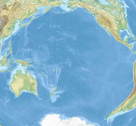
History of development
The peoples who inhabited the Pacific coast on different continents knew a lot about its individual parts, but did not represent the full power and size of this body of water. The first European who saw a small coastal bay was the Spaniard - the conquistador Vasco de Balboa, who for this overcame the high mountain ranges of the Isthmus of Panama. He took what he saw for the sea and called it the South. That is why the discovery of the Pacific Ocean and giving it its present name is the merit of Magellan, who was very lucky with the conditions in which he crossed its southern part. This name does not at all correspond to the true nature of this aquatic giant, but it has taken root more than all the others that have been proposed as it has been studied. Many expeditions followed in the footsteps of Magellan, the Pacific Ocean attracted new researchers with a large number of questions. The Dutch, the British, the Spaniards were looking for ways to communicate with known lands and in parallel opened new ones. Everything was of interest to researchers: what is the greatest depth of the Pacific Ocean, the speed and direction of movement of water masses, salinity, flora and fauna of waters, etc. Scientists managed to collect more accurate information in the 19th-20th centuries, this is the period of formation of oceanology as a science. But the first attempt to determine the depth of the Pacific Ocean was made by Magellan using a hemp line. He failed - the bottom could not be reached. A lot of time has passed since then, and today the results of ocean depth measurements can be seen on any map. Modern scientists use improved technology and can, with a high degree of probability, indicate where the depth of the Pacific Ocean is maximum, where places with a lower level lie, and where shoals lie.
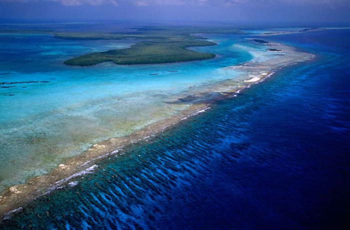
Bottom relief
More than 58% of the earth's surface is occupied by the ocean floor. It has a varied relief - these are large plains, high ridges and deep depressions. In percentage terms, the ocean floor can be divided as follows:
- Continental shallow (depth from 0 to 200 meters) - 8%.
- Continental slopes (from 200 to 2500 meters) - 12%.
- Ocean bed (from 2500 to 6000 meters) - 77%.
- Maximum depths (from 6000 to 11000 meters) - 3%.
The ratio is quite approximate, 2/3 of the ocean floor was measured, and the data of various research expeditions may vary due to constant movement. The accuracy of measuring instruments increases every year, the information obtained earlier is corrected. In any case, the greatest depth of the Pacific Ocean, its minimum value and the average value depend on the topography of the ocean floor. The smallest depths, as a rule, are observed in the territory adjacent to the continents - this is the coastal part of the oceans. It can have a length of 0 to 500 meters, the average varies within 68 meters.

The continental shelf is characterized by a slight slope, that is, it is flat, with the exception of the coasts, on which the mountain ranges are located. In this case, the relief is quite diverse, depressions and bottom cracks can reach a depth of 400-500 meters. The minimum depth of the Pacific Ocean is less than 100 meters. The large reef and its lagoons with warm clear water provide a unique opportunity to see everything that happens on the bottom. Continental slopes also vary in slope and length, depending on the location of the coastal region. Their typical structure has a smooth, gradually lowering relief or the presence of a deep canyon. They tried to explain this fact in two versions: tectonic and flooding of river valleys. In favor of the latter assumption, soil samples from their bottom, which also contains silt, speak. These canyons are quite deep, due to their average depth of the Pacific Ocean is quite impressive. The bed is a flatter part of the relief with constant depth. Cracks, crevices and depressions at the bottom of the World Ocean are a frequent phenomenon, and the maximum value of their depths, as already mentioned, is observed in the Mariana Trench. The relief of the bottom of each area is individual, it is fashionable to compare it with land landscapes.
Features of the relief of the Pacific Ocean
The depth of the abysses in the Northern Hemisphere and a significant part of the Southern Hemisphere (and this is more than 50% of the entire area of the ocean floor) varies within 5000 meters. In the northwestern part of the ocean, there are a large number of depressions and cracks that are located along the edge of the coastal zone, in the region of the continental slope. Almost all of them coincide with mountain ranges on land and have an oblong shape. This is typical for the coast of Chile, Mexico and Peru, and this group also includes the Aleutian northern basin, the Kuril and Kamchatka. In the Southern Hemisphere, a depression 300 meters long is located along the islands of Tonga, Kermadec. To find out how deep the Pacific Ocean is on average, people used various measuring instruments, the history of which is closely connected with research work in the water spaces of the planet.
Depth gauges

Lot is the most primitive means of depth measurement. It's a rope with a load on the end. This tool is not suitable for measuring sea and ocean depths, since the weight of the lowered cable will exceed the weight of the load. The results of the measurement with the help of the lot gave a distorted picture or did not bring any results at all. An interesting fact: Brook's lot was actually invented by Peter 1. His idea was that a load was attached to the cable, which popped up when it hit the bottom. This stopped the process of lowering the lot and made it possible to determine the depth. A more advanced depth gauge worked on the same principle. Its feature was the possibility of capturing part of the soil for further research. All these measuring devices have a significant drawback - the measurement time. To fix the value of a large depth, the cable must be lowered in stages over several hours, while the research vessel must stand in one place. Over the past 25 years, soundings have been carried out with the help of an echo sounder, which works on the principle of signal reflection. The operating time has been reduced to a few seconds, while on the echogram you can view the types of bottom soils and detect sunken objects. To determine what the average depth of the Pacific Ocean is, it is necessary to take a large number of measurements, which are then summed up, as a result, the delta is calculated.
History of soundings
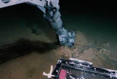
The 19th century is "golden" for oceanography in general and the Pacific Ocean in particular. The first expeditions of Kruzenshtern and Lisyansky set as their goal not only the measurement of depths, but also the determination of temperatures, pressure, density and salinity of water. 1823-1826: taking part in the research work of O. E. Kotzebue, the physicist E. Lenz used the bathometer he created. The year 1820 was marked by the discovery of Antarctica, the expedition of navigators F. F. Bellingshausen and M. P. Lazarev studied the northern seas of the Pacific Ocean. At the end of the 20th century (1972-1976), the British vessel Challenger carried out a comprehensive oceanographic survey, which provided most of the information used to this day. Since 1873, the United States, with the help of the navy, measured the depths and fixed the topography of the Pacific Ocean floor for laying a telephone cable. The 20th century was marked by a technological breakthrough for all mankind, which to a large extent affected the work of Pacific Ocean researchers, who asked a lot of questions. Swedish, British and Danish expeditions set off on a round-the-world trip to explore the largest body of water on our planet. How deep is the Pacific Ocean at its maximum and minimum? Where are these points located? What underwater or surface currents influence them? What caused them to form? The study of the bottom was carried out for a long time. From 1949 to 1957, the crew of the Vityaz research ship mapped many relief elements on a map of the Pacific Ocean floor and tracked its currents. The watch was continued by other vessels that constantly cruised in the water area to obtain the most accurate and timely information. In 1957, the scientists of the Vityaz vessel determined the point at which the greatest depth of the Pacific Ocean is observed - the Mariana Trench. Until today, its bowels are carefully studied not only by oceanologists, but also by biologists, for whom there was also a lot of interesting things.
Mariana Trench
The trench stretched for 1500 meters along the islands of the same name in the western part of the Pacific coast. It looks like a wedge and has varying depths throughout. The history of occurrence is connected with the tectonic activity of this part of the Pacific Ocean. In this segment, it gradually goes under the Philippine one, moving 2-3 cm per year. At this point, the depth of the Pacific Ocean is maximum, and the depth of the World Ocean too. Measurements have been taken for hundreds of years, and each time their values are corrected. The 2011 study gives the most surprising result, which may not be conclusive. The deepest point of the Mariana Trench is the "Challenger Abyss": the bottom is at a distance of 10,994 m below sea level. For its study, a bathyscaphe equipped with cameras and devices for soil sampling was used.
How deep is the Pacific Ocean?
There is no unequivocal answer to this question: the bottom topography is so complex and not fully understood that each figure mentioned can be corrected in the near future. The average depth of the Pacific Ocean is 4000 meters, the smallest is less than 100 meters, the famous "Challenger Abyss" is characterized by impressive figures - almost 11,000 meters! There are a number of depressions along the mainland, which also amaze with their depths, for example: the Vityaz 3 depression (Tonga trench, 10,882 meters); "Argo" (9165, Northern New Hebrides Trench); Cape Johnson (Philippine Trench, 10,497), etc. The Pacific Ocean contains the largest number of the deepest points of the World Ocean. Modern oceanologists expect a lot of interesting work and amazing discoveries.
Flora and fauna
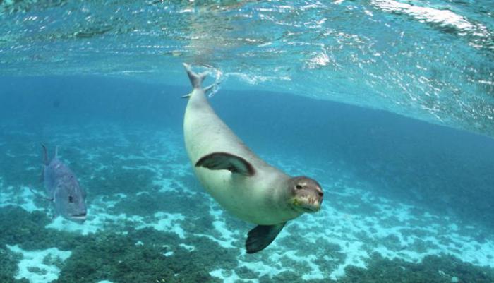
Notable for researchers is the fact that even at a maximum depth of 11,000 meters, biological activity was found: tiny microorganisms survive without light, while being subjected to the monstrous pressure of many tons of water. The vastness of the Pacific Ocean itself is an ideal habitat for many species of animals and plants. Which is confirmed by facts and concrete figures. More than 50% of the biomass of the World Ocean lives in the Pacific, the diversity of species is explained by the fact that vast expanses of water are located in all belts of the planet. Tropical and subtropical latitudes are more densely populated, but the northern borders are not empty either. A characteristic feature of the fauna of the Pacific Ocean is endemism. Here are the habitats of the most ancient animals of the planet, endangered species (sea lions, sea otters). Coral reefs are one of the wonders of nature, and the richness of flora and fauna attracts not only a lot of tourists, but also explorers. The Pacific Ocean is the largest and most powerful. The task of people is to study and understand all the processes taking place in it, which will help reduce the degree of harm caused by humans to this unique ecosystem.