Monaco, a tiny state, has 18,700 inhabitants per square kilometer. By the way, the area of Monaco is only 2 square kilometers. What about the countries with the smallest population density? Well, such statistics are also available, but the figures may vary slightly due to the constant change in the number of inhabitants. However, the countries below end up on this list anyway. Let's watch!
Just don't say you've never heard of such a country! A small state is located on the northeast coast of South America, and this, by the way, is the only English-speaking country on the continent. The area of Guyana is commensurate with the area of Belarus, while 90% of the people live in coastal areas. Almost half of the population of Guyana are Indians, and blacks, Indians and other peoples of the world also live here.
Botswana, 3.4 people/sq.km
A state in South Africa, bordering South Africa, is 70% the territory of the harsh Kalahari Desert. The area of Botswana is quite large - the size of Ukraine, but the population there is 22 times less than in this country. The Tswana people live in Botswana for the most part, and other African peoples are represented in small groups, most of which are Christians. 
Libya, 3.2 people/sq.km
The state in North Africa on the Mediterranean coast is quite large in area, however, the population density is low. 95% of Libya is desert, but cities and towns are distributed relatively uniformly throughout the country. Most of the population are Arabs, in some places there are Berbers and Tuareg, there are small communities of Greeks, Turks, Italians and Maltese. 
Iceland, 3.1 people/sq.km
The state in the north of the Atlantic Ocean is completely located on a fairly large island of the same name, on which Icelanders, descendants of the Vikings who speak Icelandic, as well as Danes, Swedes, Norwegians and Poles, mostly live. Most of them live in the Reykjavik area. Interestingly, the level of migration in this country is extremely low, despite the fact that many young people leave to study in neighboring countries. After graduation, the majority returns for permanent residence in their beautiful country. 
Mauritania, 3.1 people/sq.km
The Islamic Republic of Mauritania is located in West Africa, washed by the waters of the Atlantic Ocean in the west, and borders on Senegal, Mali and Algeria. The population density in Mauritania is about the same as in Iceland, but the country's territory is 10 times larger, and the people also live here 10 times more - about 3.2 million people, among whom there are most of the so-called black Berbers, historical slaves, and also white Berbers and blacks who speak African languages. 
Suriname, 3 people/sq.km
The Republic of Suriname is located in the northern part of South America.
A country the size of Tunisia is home to only 480,000 people, but the population is constantly growing little by little (maybe Suriname will be on this list in 10 years, say). The local population is represented mostly by Indians and Creoles, as well as Javanese, Indians, Chinese and other nations. There is probably no other country where so many languages of the world are spoken!

Australia, 2.8 people/sq.km
Australia is 7.5 times larger than Mauritania and 74 times larger than Iceland. However, this does not prevent Australia from being one of the countries with the lowest population density. Two-thirds of the Australian population lives in 5 major cities on the mainland, located on the coast. Once, until the 18th century, this mainland was inhabited exclusively by Australian Aborigines, Torres Strait Islanders and Tasmanian Aborigines, who were very different from each other even externally, not to mention culture and language. After moving to a distant "island" of immigrants from Europe, mostly from Great Britain and Ireland, the number of inhabitants on the mainland began to grow very rapidly. However, it is unlikely that the deserts scorching with heat, which occupy a decent part of the mainland, will ever be mastered by man, so only the coastal parts will be filled with inhabitants - which is happening now. 
Namibia, 2.6 people/sq.km
The Republic of Namibia in South West Africa has over 2 million people, but due to the huge problem of HIV/AIDS, the exact numbers fluctuate constantly.
Most of the population of Namibia is the people of the Bantu family and a few thousand mestizos who live mainly in the community in Rehoboth. About 6% of the population are whites - the descendants of European colonists, some of whom retain their culture and language, but still, most of them speak Afrikaans. 
Mongolia, 2 persons/sq.km
Mongolia is currently the country with the lowest population density in the world. The area of Mongolia is large, but only a little over 3 million people live in the desert territories (although at the moment there is a slight increase in population). 95% of the population are Mongols, Kazakhs are represented to a small extent, as well as Chinese and Russians. It is estimated that more than 9 million Mongols live outside the country, mostly in China and Russia. 
the degree of population, the density of the population of the area. It is expressed as the number of permanent residents per unit of total area (usually per 1 km2) of territory. When calculating P. n. sometimes uninhabited territory is excluded, as well as large inland waters. Density indicators are used separately for rural and urban population. P. n. varies greatly across continents, countries and parts of the country, depending on the nature of the settlement of people, the density and size of settlements. In large cities and urban areas, it is usually much higher than in rural areas. Therefore, P. n. of any area is the average of the population levels of individual parts of this area, weighted by the size of their territory.
Being one of the conditions for the reproduction of the population, P. n. has some effect on its growth rate. However, P. n. does not determine the growth of the population and, moreover, the development of society. Increase and uneven increase of P. n. in separate parts of a country it is the result of the development of productive forces and the concentration of production. Marxism denies the views according to which P. n. characterizes absolute overpopulation.
In 1973, the average P. n. inhabited continents was 28 people. per 1 km2, including Australia and Oceania ≈ 2, America ≈ 13 (North America ≈ 14, Latin America ≈ 12), Africa ≈ 12, Asia ≈ 51, Europe ≈ 63, USSR ≈ 11, and in the European part ≈ 34, in the Asian part ≈ about 4 people. per 1 km2.
See also Art. Population.
Lit .: National economy of the USSR in 1973, M., 1974, p. 16≈21; The population of the countries of the world. Handbook, ed. B. Ts. Urlanis, M., 1974, p. 377-88.
A. G. Volkov.
The uneven distribution of the world's population
The world population has already exceeded 6.6 billion people. All these people live in 15-20 million different settlements - cities, towns, villages, villages, farms, etc. But these settlements are located extremely unevenly across the earth's land. So, according to available estimates, half of all mankind lives on 1/20 of the inhabited land area.

Rice. 46. Cultural regions of the world (from the American textbook "Geography of the World")
The uneven distribution of the population on the globe is explained by four main reasons.
The first reason is the influence of the natural factor. It is clear that vast areas with extreme natural conditions (deserts, ice expanses, tundra, high mountains, tropical forests) do not create favorable conditions for human life. This can be illustrated by the example of table 60, which shows well both general patterns and differences between individual regions.
The main general pattern is that 80% of all people live in lowlands and uplands up to 500 m high, which occupy only 28% of the earth's land, including in Europe, Australia and Oceania, more than 90% of the total population live in such areas, in Asia and North America - 80% or so. But, on the other hand, in Africa and South America, 43–44% of people live in territories exceeding 500 m in height. Similar unevenness is also characteristic of individual countries: the most “low” include, for example, the Netherlands, Poland, France, Japan , India, China, USA, and to the most "sublime" - Bolivia, Afghanistan, Ethiopia, Mexico, Iran, Peru. At the same time, most of the population is concentrated in the subequatorial and subtropical climatic zones of the Earth.
The second reason is the effect historical features settlement of the earth's land. After all, the distribution of the population on the territory of the Earth has evolved throughout the history of mankind. The process of formation of modern humans, which began 40–30 thousand years ago, took place in Southwest Asia, Northeast Africa and Southern Europe. From here, people then spread throughout the Old World. Between the thirtieth and tenth millennia BC, they settled North and South America, and at the end of this period, Australia. Naturally, the time of settlement to some extent could not but affect the population.
The third reason is the differences in modern demographic situation. It is clear that the number and density of the population increase most rapidly in those countries and regions where its natural increase is the highest.
Table 60
DISTRIBUTION OF THE POPULATION OF THE EARTH BY ALTITUDE ZONES

Bangladesh is a prime example of this. This country with a small area and very high natural population growth already has a population density of 970 people per 1 km2. If the current level of birth rate and growth here continue, then, according to calculations, in 2025 the population density of the country will exceed 2000 people per 1 km 2!
The fourth reason is the impact socio-economic conditions people's lives, their economic activity, the level of development of production. One of its manifestations can be the “attraction” of the population to the coasts of the seas and oceans, more precisely, to the “land-ocean” contact zone.
The area located at a distance of up to 50 km from the sea can be called zone of direct coastal settlement. It is home to 29% of all people, including 40% of all urban dwellers in the world. This share is especially high in Australia and Oceania (about 80%). This is followed by North America, South America and Europe (30-35%), Asia (27%) and Africa (22%). The zone separated from the sea by 50-200 km can be considered as indirectly connected with the coast: although the settlement itself here is no longer coastal, in economic terms it feels the daily and significant influence of the proximity of the sea. Approximately 24% of the total population of the Earth is concentrated in this zone. The literature also notes that the proportion of the population living at a distance of up to 200 km from the sea is gradually increasing: in 1850 it was 48.9%, in 1950 - 50.3, and now it reaches 53%.
It is possible to concretize the thesis itself about the uneven distribution of the population across the globe using many examples. One can compare in this respect the Eastern and Western hemispheres (respectively 80 and 20% of the population), the Northern and Southern hemispheres (90 and 10%). It is possible to single out the least and most populated areas of the Earth. The former include almost all highlands, most of the giant deserts of Central and Southwest Asia and North Africa, and to some extent tropical forests, not to mention Antarctica and Greenland. The latter include the historically established main population clusters in East, South and Southeast Asia, in Western Europe, and in the Northeast of the United States.
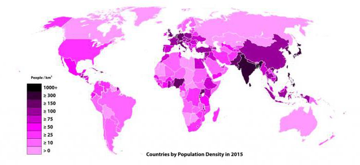
Various indicators are used to characterize the distribution of the population. The main one, the population density indicator, makes it possible to more or less visually judge the degree of population of the territory. It determines the number of permanent residents per 1 km2.
Let's start with the average population density for all inhabited earth's land.
As one would expect, during the twentieth century. - especially as a result of the population explosion - it began to increase especially rapidly. In 1900, this figure was 12 people per 1 km 2, in 1950 - 18, in 1980 - 33, in 1990 - 40, and in 2000 already about 45, and in 2005 - 48 people per 1 km 2.
It is also interesting to consider the differences in average population density that exist between parts of the world. Populous Asia has the highest density (120 people per 1 km 2), Europe is very high (110), while in other large parts of the Earth the population density is below the world average: in Africa about 30, in America - 20, and in Australia and Oceania - only 4 people per 1 km 2.
The next level is a comparison of the population density of individual countries, which makes it possible to carry out Figure 47. It also provides the basis for a three-term grouping of the countries of the world according to this indicator. A very high population density for a single country can, obviously, be considered an indicator of over 200 people per 1 km 2. Examples of countries with such a population density are Belgium, the Netherlands, Great Britain, Germany, Japan, India, Israel, Lebanon, Bangladesh, Sri Lanka, the Republic of Korea, Rwanda, El Salvador. The average density can be considered an indicator close to the world average (48 people per 1 km 2). As examples of this kind, we will name Belarus, Tajikistan, Senegal, Côte d'Ivoire, Ecuador. Finally, 2–3 people per 1 km 2 or less can be attributed to the lowest density indicators. The group of countries with such a population density includes Mongolia, Mauritania, Namibia, Australia, not to mention Greenland (0.02 people per 1 km 2).
When analyzing Figure 47, it should be taken into account that very small, mostly island, countries could not be reflected in it, and it is precisely they that are distinguished by particularly high population density. Examples include Singapore (6450 people per 1 km 2), Bermuda (1200), Malta (1280), Bahrain (1020), Barbados (630), Mauritius (610), Martinique (350 people per 1 km 2) not to mention Monaco (16,900).
In educational geography, the consideration of population density contrasts within individual countries is quite widely used. Egypt, China, Australia, Canada, Brazil, Turkmenistan, and Tajikistan can be cited as the most striking examples of this kind. At the same time, one should not forget about the archipelago countries. For example, in Indonesia, the population density on about. Java often exceeds 2000 people per 1 km 2, and in the deep regions of other islands it drops to 3 people per 1 km 2. It should be noted in passing that, if the relevant data are available, it is better to analyze such contrasts on the basis of a comparison of the density of the rural population.
Russia is an example of a country with a low average population density of 8 people per 1 km 2 . In addition, this average hides very large internal differences. They exist between the Western and Eastern zones of the country (respectively 4/5 and 1/5 of the total population). They also exist between individual regions (the population density in the Moscow region is approximately 350 people per 1 km 2, and in many regions of Siberia and the Far East - less than 1 person per 1 km 2). That is why geographers usually single out in Russia the main strip of settlement, extending in a gradually narrowing range through the European and Asian parts of the country. About 2/3 of all the inhabitants of the country are concentrated within this band. At the same time, there are vast uninhabited or very sparsely populated territories in Russia. They occupy, according to some estimates, approximately 45% of the entire area of the country.

Rice. 47. Average population density by country
The population on Earth is distributed unevenly. This is due to various reasons:
a) the influence of the natural factor: deserts, tundra, highlands, ice-covered territories and tropical forests do not contribute to the resettlement of people;
b) the effect of the historical features of the settlement of the earth's land;
c) differences in the current demographic situation: features of population growth on the continents;
d) the influence of the socio-economic conditions of people's lives, their economic activities, the level of development of production.
Countries with the highest population density have 200 people per 1 km2. This group includes: Belgium, Netherlands, Germany, Great Britain, Israel, Lebanon, Bangladesh, India, Republic of Korea, Japan, Philippines. Countries in which the population density is close to the world average - 46 abs/km2: Cambodia, Iraq, Ireland, Malaysia, Morocco, Tunisia, Mexico, Ecuador. Low population density - 2 individuals / km2 have: Mongolia, Libya, Mauritania, Namibia, Guinea, Australia.
The total population density of the Earth is constantly changing. If in 1950 it was 18 abs/km2, in 1983 it was 34, in the early 1990s it was 40, and in 1997 it was 47. 4/5 - at altitudes up to 500 m above sea level. Sparsely populated or completely uninhabited territories (including the continental glaciers of Antarctica and Greenland) occupy almost 40% of the land area, 1% of the world's population plays here.
In the most populated areas of the world, occupying up to 7.0% of the territory, up to 70% of the total population of the Earth lives.
Significant concentrations of the population were formed both in the old agricultural and in the new industrial areas. Particularly high population density is in the industrialized regions of Europe, North America, as well as in the ancient areas of artificial irrigation (Ghana, Nile and Great China lowlands). Here, in the most densely populated areas of the globe, they occupy less than 10% of the land, about 2/3 of the world's population lives. Asia is the most populated part of the world. The demographic center in Asia is located in the region of the Hindustan subcontinent. The most populated here are areas of intensive agriculture, in particular rice cultivation: the Ganges delta from the Brahmaputra, Irrawaddy. In Indonesia, the majority of the population is concentrated on the island of Java with fertile soils of volcanic origin (population density exceeds 700 abs/km2).
The rural population of Southwest Asia is concentrated along the foothills of Lebanon, Elbrus, in the interfluve of the Tigris and Euphrates. A fairly high population density on the coast of the Persian Gulf, which is associated with oil production, as well as around the Sea of Japan (on the Japanese islands - more than 300 abs/km2, in South Korea - about 500 abs/km2).
Europe is unevenly populated. One densely populated region stretches from north to south—from Northern Ireland through England, through the Rhine Valley to northern Italy—and is interrupted only in the Alps. This belt concentrates many industries and intensive agriculture, developed infrastructure. The second runs in the west of Europe from Brittany, along the Sambor and Meuse rivers through northern France and Germany. The high concentration of population in Northwestern Europe is explained by the fact that it was here that industrial areas were born, which led to an increase in natural population growth and an influx of labor. About 130 million people live in Western, Central, Southwestern and Southern France, on the Iberian, Apennine peninsulas, on the Mediterranean islands. The average population density here reaches 119 abs/km2.
Among the countries of Central and Eastern Europe, Ukraine has a high population density - 81 persons / km2, Moldova - 130 persons / km2. The average population density in Russia is 8.7 individuals/km2.
Sufficiently high population density is typical for a number of Central European countries, but it is distributed unevenly. Sparsely populated are mountainous areas and forests. The usual population density in Poland is 127 abs/km2, with a maximum of more than 300 in the industrial regions of Upper and Lower Silesia. The population density of the Czech Republic is 134 individuals / km2, Slovakia - 112, Hungary - 111. Many populations of the eastern part of Southern Europe are concentrated on the coast of the Adriatic Sea, per 1 km2 there are: in Serbia, Montenegro - 42 people each, Slovenia - 100, Macedonia - 4 , Croatia - 85, Bosnia and Herzegovina - 70 axles/km2.
The distribution of the population in North America largely depends on the time of settlement of individual territories. The bulk of the population of the United States and Canada is concentrated to the east of 85 ° N. in the region bounded by the Atlantic coast, a narrow strip of the border between the United States and Canada (to the Great Lakes), the southern shores of the lakes in the year of the Mississippi and Ohio. About 130 million people live in this part of the mainland.
In the region of Central America, the Antilles are especially densely populated: in Jamaica, there are 200 people per 1 km2, in Trinidad, Tobago and Barbados - 580 people. Low population density in the desert regions of northwestern Mexico.
A significant number of South Americans live in coastal areas on the western and eastern fringes of the continent. Large areas of the equatorial forests of the Amazon and savannahs (Chaco), as well as Patagonia and Tierra del Fuego, are underpopulated.
On the African continent, the population density is very low. Individuals of the cause are natural conditions (deserts, humid equatorial forests, mountainous territories), as well as colonization, the slave trade in the past. Most of the population is concentrated in coastal areas, where large cities or plantations are concentrated. These are the Mediterranean regions of the Maghreb, the shores of the Gulf of Guinea from Côte d'Ivoire to Cameroon, as well as the plains of Nigeria.
Australia has the most densely populated territories in the eastern, southeastern outskirts of the continent.
Severe climatic conditions prevented the settlement of the Arctic and subarctic zones; less than 0.1% of the world's population lives here.
True, in modern conditions the role of contrasts caused by natural conditions is decreasing. In connection with industrialization, the introduction of scientific and technological progress, socio-economic factors have an increasingly greater influence on the distribution of the population.
The world's population is distributed very unevenly across the territory. This is easy to track using such a concept as the average population density, that is, the number of inhabitants of the world, country or city per square kilometer. The average density of countries varies hundreds of times. And inside the countries there are absolutely deserted places, or vice versa, cities in which several hundred people live per square meter. East and South Asia, Western Europe are especially densely populated, and the Arctic, deserts, tropical forests and highlands are poorly populated.
The population of the world is extremely uneven. About 70% of the total population of the planet lives on 7% of the land area. At the same time, almost 80% of the world's population lives in its eastern part. The main parameter that shows the distribution of the population is the population density. The average value of the world population density is 40 people per square km. At the same time, this indicator varies depending on the location, and can be from 1 to 2000 people per kilometer.
The lowest population density (less than 4 people per kilometer) is Mongolia, Australia, Namibia, Libya and Greenland. And the highest population density (from 200 people per square kilometer or more) is in Belgium, the Netherlands, Great Britain, Israel, Lebanon, Bangladesh, Korea, El Salvador. Average population density in countries: Ireland, Iraq, Morocco, Malaysia, Ecuador, Tunisia, Mexico. There are also areas with extreme conditions that are not suitable for life; they belong to undeveloped territories and occupy approximately 15% of the land area.
Over the past ten years, in several places in the world, huge crowds of people called conurbation have appeared.
They are constantly increasing, and the largest of these formations is Boston, located in the United States.
Gigantic differences between regions in the rate of development and population growth are rapidly changing the population map of the planet.
Russia can be classified as a sparsely populated country. The population of the state is disproportionate compared to the vast territory. Most of Russia is occupied by the far north and areas equated to it, the average population density of which is 1 person per square meter.
The world is gradually changing, and at the same time comes to the modern mode of reproduction, in which low birth rates and low mortality, which means that soon the number, and hence the population density of countries, will stop increasing, but will stand at the same level.
Steadily growing. But at the same time, people are distributed very unevenly over the surface of the planet. What is it connected with? Let's talk about which country has the highest population density and how this can be explained.
Earth's population: features
Throughout the history of the Earth, peoples have migrated around the planet in search of better conditions for life. Initially, people settled in places with a warm climate, near water, with enough food and other resources. It is in such points that today there is a greater number of people living than in areas with more severe living conditions. That is why the countries with the greatest predominance in warm latitudes. Later, when all favorable zones were intensively populated, people began to move to less comfortable places. Civilization made it possible to deal with deprivation without great expense. And peoples began to strive to those places where comfortable conditions for existence have already been created. That is why today they are much more attractive to migrants than developing ones. Also, demography is highly dependent on the culture and traditions of the people. Therefore, countries with the highest population density are states in which it is customary to have many children.
The concept of population density
Observations of demographics on Earth began as early as the 17th century. During the Industrial Revolution, they became essential for good planning and resource use. In the 20th century, population density is added to traditional demographic indicators. It is calculated based on the area of the country and the total number of its inhabitants. Knowing how many people there are per 1 square kilometer, taking into account the number of births and deaths, allow us to calculate how many different material benefits people will need: food, housing, clothing, etc. and plan a competent life support for the population.
In the first quarter of the 20th century, countries with the highest population density were identified for the first time and the first scenarios were developed for the further development of the demographic situation on Earth. Today, the average on the planet is 45 people per 1 sq. km. km, but due to the increase in the number of earthlings, this figure is gradually increasing.

The value of the population density indicator and the factors affecting it
Demographic calculations are initially associated with the rational use of natural resources. Back in 1927, sociologists introduced the term "optimal density", but have not yet decided on its numerical expression. Observations of this indicator are necessary in order to identify countries with the highest population density, because they are a potential focus of social tension. The more people live in a limited space, the more intense the competition between them for vital resources. Information on density predictions allows you to start solving this problem in advance and find ways to eliminate it.
This indicator is influenced by several main factors. These are, firstly, the natural conditions of life: people like to live in warm countries with a good climate, which is why the shores of the Mediterranean Sea and the Indian Ocean, the equatorial zones are so densely populated. It is also common for peoples to strive to where comfortable, modern living conditions already exist, with sufficient social security. Therefore, the flow of migrants to the developed countries of Europe, the USA, New Zealand, and Australia is so great. The number of inhabitants is directly affected by the culture of the nation. Thus, the Muslim religion is built on the value of a large family, therefore, in the countries of Islam, the population is higher than in Christian countries. Another factor affecting the density is the development of medicine, in particular the use of contraception.

List of countries
The answer to the question of which countries has the highest average population density does not have a clear answer. Since the ratings are based on the results of national population censuses, and they are held in all states at different times, and therefore there are no exact figures on the number of inhabitants at a certain point. But there are stable indicators and forecasts that make it possible to compile the TOP-10 countries with the highest density. Monaco always ranks first (a little less than 19 thousand people per 1 sq. km), followed by Singapore (about 7.3 thousand people per 1 sq. km), the Vatican (about 2 thousand people per 1 sq. km). sq. km), Bahrain (1.7 thousand people per 1 sq. km), Malta (1.4 thousand people per 1 sq. km), Maldives (1.3 thousand people per 1 sq. km). km), Bangladesh (1.1 thousand people per 1 sq. km), Barbados (0.6 thousand people per 1 sq. km), China (0.6 thousand people per 1 sq. km) and Mauritius (0.6 thousand people per 1 sq. km). The last three states in the list often change their positions in accordance with the latest data.
Most populous regions
If you look at a world map in order to find out where people live the most, you can easily see that the highest density is in Europe, Southeast Asia and some countries in Africa. When we explore Asia and ask ourselves which countries in the region have the highest population density, we can say that the leaders here are Singapore, Hong Kong, Maldives, Bangladesh, Bahrain. These states do not have birth control programs. But China was able to curb the growth in numbers and today is in 134th place in the world in terms of density, although until recently it was in the lead.

Population density outlook
Describing countries with a high population density, sociologists look to the future with pessimism. Asia's growing population is a potentially conflict zone. Today we already see how migrants are besieging Europe, and the resettlement process will continue. Since no one can stop the growth of the number of inhabitants on Earth, it is obvious that the population density will only grow. And a large crowding of people always leads to conflicts for resources.
Today's holiday, World Population Day, is dedicated to humanity, which not so long ago exceeded the mark of 7 billion. On the occasion of the planet's population continuing to increase every hour, we propose to study the most densely populated cities on Earth.
The main city of Taiwan, which has determined the vector of economic and urban development for communist China since the eighties, surprisingly manages to combine population density with the comfort of its stay. In general, even the city metro is not particularly overloaded here.

The capital of the Philippines, famous for its incredible number of ancient churches and temples, rightfully bears the title of the most populous city in the world for many years. The population density of Manila is more than forty thousand people per square kilometer - an unattainable record. Although, if we take into account the agglomeration, the picture will not be so sad - just over ten thousand per kilometer.

The Indian city is the fourth most populous in the country, but the first in its density. Rightfully considered an educational and cultural center, Calcutta has not escaped all the side effects of overcrowding - massive slums with their half-starved inhabitants.

Also known as Bombay, the most populous city in India, which has passed the demographic mark of one billion people, simply could not help but be one of the global settlements with a record high population density. The figure is five thousand less than in Calcutta, and two times lower than in Manila, which, however, does not make it less impressive and terrifying at the same time.

With a population of just over two million people (this is without taking into account the numerous suburbs, where five times as many people work in the capital), it has become one of the most densely populated cities in the world due to its compact size - only a hundred square kilometers (25 times less than than Moscow Square!). At the same time, it does not cause the effect of overcrowding, unlike the same one dotted with slums.

The eight millionth capital of Egypt is famous for its quarters, more like huge monumental buildings, a city of scavengers and traffic lights that can be counted on the fingers. The first of the city's dubious sights did not appear from a good life - with the constantly high number of internal migrants arriving in the city, Cairo has nowhere to expand.

With a vast agglomeration, in the center of the largest city of Pakistan, so to speak, there is no crowding - more than ten million people live on just over five hundred square kilometers. More of them arrive at the center each morning for work from far-flung neighborhoods.

In terms of population and population density, the largest city in Nigeria is rapidly catching up with the Egyptian capital - having recruited almost five million people in a decade, the important African port has reached the mark of eighteen thousand people per square kilometer. And Lagos is clearly not going to stop there.

China's Shenzhen, which sets records in terms of population growth, has long overtaken other cities of the Celestial Empire, which do not differ in an abundance of free space, in terms of the number of people per unit area. In addition to the traditionally not the best ecological condition in the whole country, Shenzhen, being the main business center of China, was able to avoid the main problems of overpopulation.

The capital of South Korea is filling up with people clearly faster than it has time to grow. With a population density of almost eighteen thousand people per square kilometer, it continues to be one of the most livable cities in the world.

Another Indian city on the list, following the example of its counterparts, is not too bothered to deal with the problems associated with overpopulation. Being the fourth largest in India, Chennai suffers from the usual problems for the region - slums, streets clogged with traffic, problems with communications and sanitary conditions of citizens.

The Colombian capital is always included in the lists of dynamically developing cities in the world - the city government deserves the respect of many international authorities for its efforts and success in solving the problems of the most populous city in South America. Of course, there are also slums formed by new migrants, but Bogota manages its almost eleven million people by far the best in the region.

The largest city in China and the first most populous city in the world could not be left out of this selection. Due to the rather vast territory occupied by Shanghai, it is in one of the last positions, more or less successfully distributing a damn dozen thousand people over its 746 square kilometers. And if we take into account the agglomeration, then the business capital of the Celestial Empire can be considered a city of free spaces.

A small Belarusian mining town may seem like an alien, it is unclear how it got on this list, but the facts speak for themselves - with an area of only ten square kilometers, the town is inhabited by more than one hundred thousand people. Unlike other small settlements, Soligorsk is not expanding, but compacting, sacrificing green spaces.

The area occupied by Lima usually does not take into account the huge slums on the outskirts of the city and the numerous small towns of the agglomeration. The main part of the seven million population of the Peruvian capital is concentrated on six hundred square kilometers of area, which allows the city to take the last place among the fifteen overpopulated settlements of the world.
Monaco, a tiny state, has 18,700 inhabitants per square kilometer. By the way, the area of Monaco is only 2 square kilometers. What about the countries with the smallest population density? Well, such statistics are also available, but the figures may vary slightly due to the constant change in the number of inhabitants. However, the countries below end up on this list anyway. Let's watch!
Guyana, 3.5 people/sq.km
Just don't say you've never heard of such a country! A small state is located on the northeast coast of South America, and this, by the way, is the only English-speaking country on the continent. The area of Guyana is commensurate with the area of Belarus, while 90% of the people live in coastal areas. Almost half of the population of Guyana are Indians, and blacks, Indians and other peoples of the world also live here.
Botswana, 3.4 people/sq.km
A state in South Africa, bordering South Africa, is 70% the territory of the harsh Kalahari Desert. The area of Botswana is quite large - the size of Ukraine, but the population there is 22 times less than in this country. The Tswana people live in Botswana for the most part, and other African peoples are represented in small groups, most of which are Christians. 
Libya, 3.2 people/sq.km
The state in North Africa on the Mediterranean coast is quite large in area, however, the population density is low. 95% of Libya is desert, but cities and towns are distributed relatively uniformly throughout the country. Most of the population are Arabs, in some places there are Berbers and Tuareg, there are small communities of Greeks, Turks, Italians and Maltese. 
Iceland, 3.1 people/sq.km
The state in the north of the Atlantic Ocean is completely located on a fairly large island of the same name, on which Icelanders, descendants of the Vikings who speak Icelandic, as well as Danes, Swedes, Norwegians and Poles, mostly live. Most of them live in the Reykjavik area. Interestingly, the level of migration in this country is extremely low, despite the fact that many young people leave to study in neighboring countries. After graduation, the majority returns for permanent residence in their beautiful country. 
Mauritania, 3.1 people/sq.km
The Islamic Republic of Mauritania is located in West Africa, washed by the waters of the Atlantic Ocean in the west, and borders on Senegal, Mali and Algeria. The population density in Mauritania is about the same as in Iceland, but the country's territory is 10 times larger, and the people also live here 10 times more - about 3.2 million people, among whom there are most of the so-called black Berbers, historical slaves, and also white Berbers and blacks who speak African languages. 
Suriname, 3 people/sq.km
The Republic of Suriname is located in the northern part of South America. A country the size of Tunisia is home to only 480,000 people, but the population is constantly growing little by little (maybe Suriname will be on this list in 10 years, say). The local population is represented mostly by Indians and Creoles, as well as Javanese, Indians, Chinese and other nations. There is probably no other country where so many languages of the world are spoken!

Australia, 2.8 people/sq.km
Australia is 7.5 times larger than Mauritania and 74 times larger than Iceland. However, this does not prevent Australia from being one of the countries with the lowest population density. Two-thirds of the Australian population lives in 5 major cities on the mainland, located on the coast. Once, until the 18th century, this mainland was inhabited exclusively by Australian Aborigines, Torres Strait Islanders and Tasmanian Aborigines, who were very different from each other even externally, not to mention culture and language. After moving to a distant "island" of immigrants from Europe, mostly from Great Britain and Ireland, the number of inhabitants on the mainland began to grow very rapidly. However, it is unlikely that the deserts scorching with heat, which occupy a decent part of the mainland, will ever be mastered by man, so only the coastal parts will be filled with inhabitants - which is happening now. 
Namibia, 2.6 people/sq.km
The Republic of Namibia in South West Africa has over 2 million people, but due to the huge problem of HIV/AIDS, the exact numbers fluctuate constantly. Most of the population of Namibia is the people of the Bantu family and a few thousand mestizos who live mainly in the community in Rehoboth. About 6% of the population are whites - the descendants of European colonists, some of whom retain their culture and language, but still, most of them speak Afrikaans. 
Mongolia, 2 persons/sq.km
Mongolia is currently the country with the lowest population density in the world. The area of Mongolia is large, but only a little over 3 million people live in the desert territories (although at the moment there is a slight increase in population). 95% of the population are Mongols, Kazakhs are represented to a small extent, as well as Chinese and Russians. It is estimated that more than 9 million Mongols live outside the country, mostly in China and Russia. 
10
- Density: 635.19 people/km2
- Square: 2040 km 2
- Population: 1,295,789 people
- Motto:"Star and Key of the Indian Ocean"
- Form of government: Parliamentary republic
- Capital: Port Louis
Island nation in East Africa. Located in the southwestern Indian Ocean, about 900 km east of Madagascar. The republic includes the islands of Mauritius (the largest, 1865 km 2) and Rodrigues (104 km 2), which are part of the Mascarene archipelago, as well as the Cargados-Carahos archipelago, the Agalega Islands and many small islands. The capital is the city of Port Louis, located on the island of Mauritius.
The economy of Mauritius is based on sugar production (sugar cane is grown on about 90% of cultivated farmland), tourism and the textile industry, which makes it the third country in terms of living standards in Africa (after Libya and the Seychelles) and 7th in terms of GDP per capita (after Equatorial Guinea, Libya, Seychelles, Gabon, Botswana and Tunisia). Recently, offshore and banking business has been developing, as well as the extraction and processing of seafood and fish. In terms of competitiveness in Africa, it ranks 5th (after South Africa, Libya, Botswana and Gabon).
Mauritius has an armed force of about 20 thousand people, which are used to eliminate the consequences of natural disasters (typhoons), and are a kind of analogue of the forces of the Ministry of Emergency Situations, there is a police force, police special forces and a maritime patrol service.
9

- Density: 648 people/km2
- Square: 35,980 km2
- Population: 23,299,716 people
- Form of government: mixed republic
- Capital: Taipei
A partially recognized state in East Asia that previously had a one-party system, broad diplomatic recognition and control over all of China, has now become a democratic state with limited diplomatic recognition and controls only Taiwan and the surrounding islands. She is one of the founders of the UN and was previously a member of the UN Security Council (in 1971, the seat of the Republic of China in the UN was transferred to the People's Republic of China). The Republic of China is recognized by 22 UN member states, but actually maintains relations with most countries of the world through its representations.
8

- Density: 660 people/km2
- Square: 439 km 2
- Population: 277,821 people
- Motto:"Pride and Industry"
- Form of government: an independent state within the Commonwealth, led by Great Britain
- Capital: bridgetown
A state in the West Indies on the island of the same name in the Lesser Antilles group, in the east of the Caribbean Sea. It is located relatively close to the South American continent, 434.5 km northeast of Venezuela.
Barbados is one of the leading developing countries in terms of living standards and literacy of the population according to the United Nations Development Program (UNDP), being in fourth place. Education is based on the British model. It costs about 20% of the country's annual budget. The literacy rate is close to 100%.
Tourism is well developed in the country (suitable climate, developed transport infrastructure), sugar industry. Information technologies and financial services are new directions of economic development.
In Barbados, to a greater extent than in other islands of the West Indies, there is an influence of English culture. A perfect example of this is the national sport - cricket.
7

- Density: 1154.7 people/km2
- Square: 147,570 km2
- Population: 168,957,745 people
- Form of government: unitary republic
- Capital: Dhaka
Bangladesh is an agro-industrial country with a dynamically developing economy. It is distinguished by significant ethno-cultural diversity and has a rich culture that has absorbed elements of various traditions of the region.
This is one of the poorest countries in Asia. 63% of the working population is employed in agriculture. The humid tropical climate allows for year-round farming, although there are droughts in the west of the country. Residents grow rice, jute, tea (in the northeast), wheat, sugar cane, potatoes, tobacco, legumes, sunflowers, spices, fruits (including mangoes). The population periodically suffers from hunger due to floods that destroy rice crops. The country also breeds cattle (bulls and buffaloes), poultry, and fish and seafood are caught in the rivers and the Bay of Bengal (the main fishing port is Chittagong). Fish along with rice is the main element of the diet of the inhabitants of the country. The country is producing natural gas. The main industries are cotton, jute, clothing, tea, paper, cement, chemicals (fertilizers), sugar, textile engineering.
6

- Square: 300 km 2
- Population: 341,256 people
- Density: 1,359 people/km2
- Form of government: Presidential republic
- Capital: Male
The Republic of Maldives belongs to the states of South Asia and is located on a group of atolls, consisting of 1192 coral islands, in the Indian Ocean to the south of India.
The islands do not rise much above the ocean level: the highest point of the archipelago is on the southern Addu (Siena) atoll - 2.4 m. Thanks to this, the Maldives is known as the lowest located state.
The total area is 90 thousand km², the land area is 298 km 2. The capital of Male - the only city and port of the archipelago - is located on the atoll of the same name.
As for tourism, it is worth noting that all the main beauties of the Maldives are located below sea level, but there are no special sights on land. There is an unremarkable capital Male, many uninhabited islands similar to each other, where they like to have picnics, as well as a kind of "action" - a fishing excursion. Perhaps the only notable surface excursion is the Photo Flight, a seaplane flight over the islands. Other popular excursions are a yacht cruise or a submarine dive. The most common pastime among tourists in the Maldives is diving, since there are coral reefs near each island. In addition, windsurfing, catamaran, water skiing, snorkeling, beach volleyball, tennis, billiards, squash and darts are popular.
5

- Density: 1432 people/km2
- Square: 316 km 2
- Population: 429,344 people
- Motto:"Valor and perseverance"
- Form of government: parliamentary republic, democracy
- Capital: Valletta
The Republic of Malta is an island state in the Mediterranean Sea. The name comes from the ancient Phoenician malat ("harbour", "refuge").
In 1964, Malta gained independence from Great Britain, and since 1974 a republic has been proclaimed, but until 1979, when the last British naval base was liquidated in Malta, the British Queen was still considered the head of state.
The territory of Malta is represented by the Maltese archipelago, consisting mainly of the island of Malta and Gozo. It also includes the uninhabited islands of St. Paul and Filfla, the uninhabited island of Comino, and tiny Cominotto and Filfoletta. The length of Malta is 27 km, the width is 15 km (less than the diameter of the Moscow ring road). Gozo is half the size, while Comino is only 2 km long. Malta is the only country in Europe without permanent rivers and natural lakes.
4

- Density: 1626 people/km2
- Square: 765 km 2
- Population: 1,343,000 people
- Form of government: dualistic monarchy
- Capital: Manama
An island state on the archipelago of the same name in the Persian Gulf in Southwest Asia, the smallest Arab state. Bahrain occupies three relatively large and many small islands 16 km east of the coast of Saudi Arabia and is connected to this country by a road bridge.
The kingdom hosts the main operating base of the US Fifth Fleet in Juffair, near Manama.
Prior to the discovery of oil fields in 1932, pearl fishing was a branch of the economy of Bahrain (which still remains one of the main ones). Oil production and refining used to account for 60% of GDP, now it is 30%. Bahraini "black gold" deposits are depleted. Despite this, in 2015 the country produced 18.462 million barrels of oil, which is 3.7% higher than in 2014. The country also produces and processes natural gas, the reserves of which are significant. Developed offshore banking business.
3
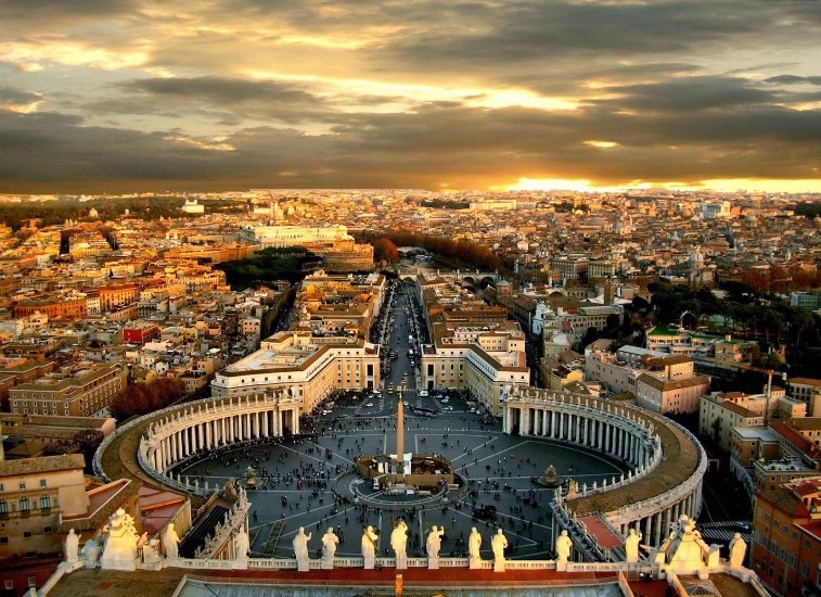
- Density: 1900 people/km2
- Square: 0.44 km2
- Population: 842 people
- Form of government: absolute theocratic monarchy
- Capital:
And, of course, the title of the smallest state in the world belongs to the Vatican. The Vatican is a dwarf enclave state (the smallest officially recognized state in the world) inside the territory of Rome, associated with Italy. The status of the Vatican in international law is an auxiliary sovereign territory of the Holy See, the seat of the highest spiritual leadership of the Roman Catholic Church.
Foreign diplomatic missions are accredited to the Holy See, not to the Vatican City State. Foreign embassies and representations accredited to the Holy See, in view of the small territory of the Vatican, are located in Rome (including the embassy of Italy, which is thus located in its own capital.
In antiquity, the territory of the Vatican (Latin ager vaticanus) was not inhabited, since in ancient Rome this place was considered holy. Emperor Claudius held circus games at this place. In 326, after the advent of Christianity, a basilica of Constantine was erected over the supposed tomb of St. Peter, and since then this place has been inhabited.
The Vatican is a theocratic state ruled by the Holy See. The Sovereign of the Holy See, in whose hands absolute legislative, executive and judicial power is concentrated, is the Pope, who is elected by the cardinals for life. After the death or abdication of the Pope and during the conclave until the enthronement of the new Pope, his duties (with significant restrictions) are performed by the Camerlengo.
The Vatican has a non-profit planned economy. Sources of income - primarily donations from Catholics around the world. Part of the funds is tourism (sale of postage stamps, Vatican euro coins, souvenirs, fees for visiting museums). Most of the workforce (museum attendants, gardeners, janitors, and so on) are Italian citizens.
The budget of the Vatican is 310 million US dollars.
The Vatican has its own bank, better known as the Institute of Religious Affairs.
2

- Density: 7 437 people/km2
- Square: 719.1 km 2
- Population: 5,312,400 people
- Motto:"Go Singapore"
- Form of government: parliamentary republic
- Capital:
Singapore is a city-state located on islands in Southeast Asia, separated from the southern tip of the Malay Peninsula by the narrow Strait of Johor. It borders on the Johor Sultanate, which is part of Malaysia, and on the Riau Islands, which is part of Indonesia.
The name Singapore comes from the Malay singa (lion), borrowed from the Sanskrit sinha (lion), and the Sanskrit pura (city).
The area of Singapore has been gradually increasing due to the land reclamation program in place since the 1960s. Currently, the state of Singapore consists of 63 islands. The largest of them are Singapore (main island), Ubin, Tekong Besar, Brani, Sentosa, Semakau and Sudong. The highest point is Bukit Timah Hill (163.3 m).
Singapore maintains diplomatic relations with 186 countries of the world, although many of them do not have its embassies. It is a member of the UN, the British Commonwealth, ASEAN and the Non-Aligned Movement.
Singapore is characterized by a favorable investment climate, a highly competitive environment, leading positions in the ratings of economic freedom, a highly educated and disciplined population, and a greatly increased standard of living. But here, unfortunately, there is also dependence on imports for almost all food, water and energy.
1

- Density: 18 679 people/km2
- Square: 2.02 km2
- Population: 30,508 people
- Motto:"God willing"
- Form of government: dualistic constitutional monarchy
- Capital:
A dwarf state associated with France, located in southern Europe on the coast of the Ligurian Sea near the French Cote d'Azur, 20 km northeast of Nice; on land borders with France. It is one of the smallest and most densely populated countries in the world. The Principality is widely known for its casinos in Monte Carlo and the Formula 1 Grand Prix of Monaco held here. The length of the coastline is 4.1 km, the length of land borders is 4.4 km. Over the past 20 years, the country's territory has increased by almost 40 hectares due to the drainage of marine areas.
The first people built their settlements on the territory of Monaco in the X century BC. e., they were the Phoenicians. Much later, the Greeks and Monoiki joined.
The history of modern Monaco begins in 1215 with the founding of a colony of the Republic of Genoa on the territory of the principality and the construction of a fortress.
According to 2014 data, the population of Monaco is 37,800 people, but it is worth noting that most of the full citizens of the state are Monegasques. They are exempt from taxes and have the right to settle in the area of the old city.
The economy of Monaco is developing mainly due to tourism, gambling, the construction of new residences, as well as through the media covering the life of the princely family.


